
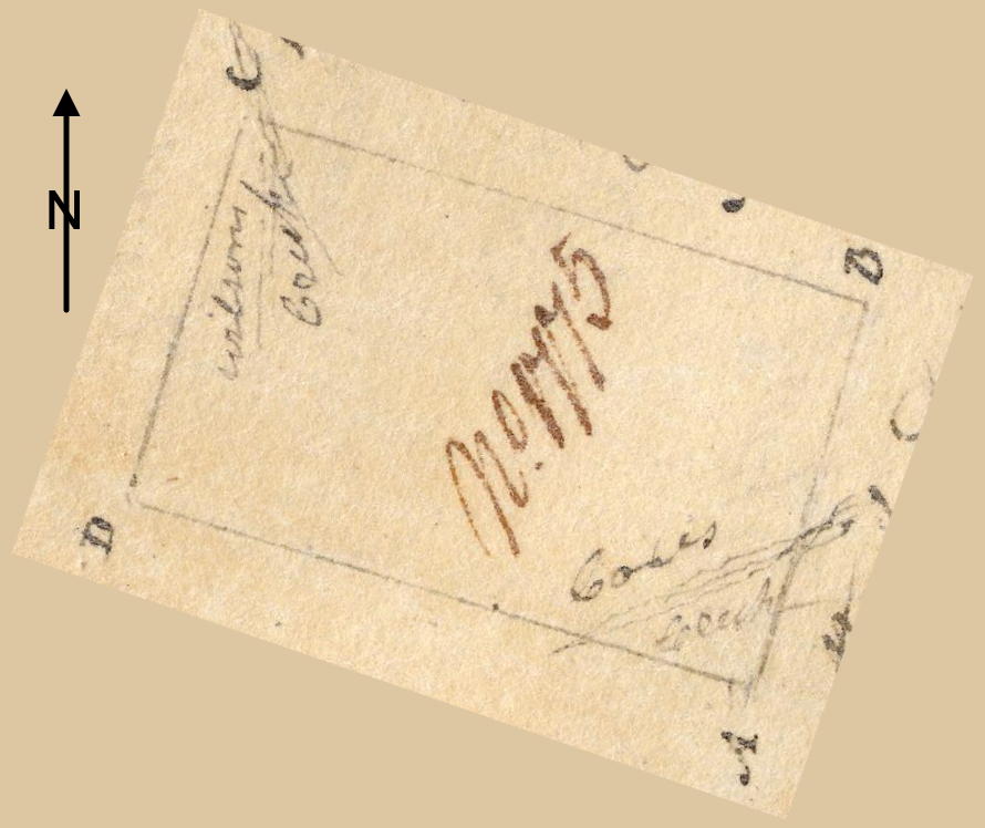
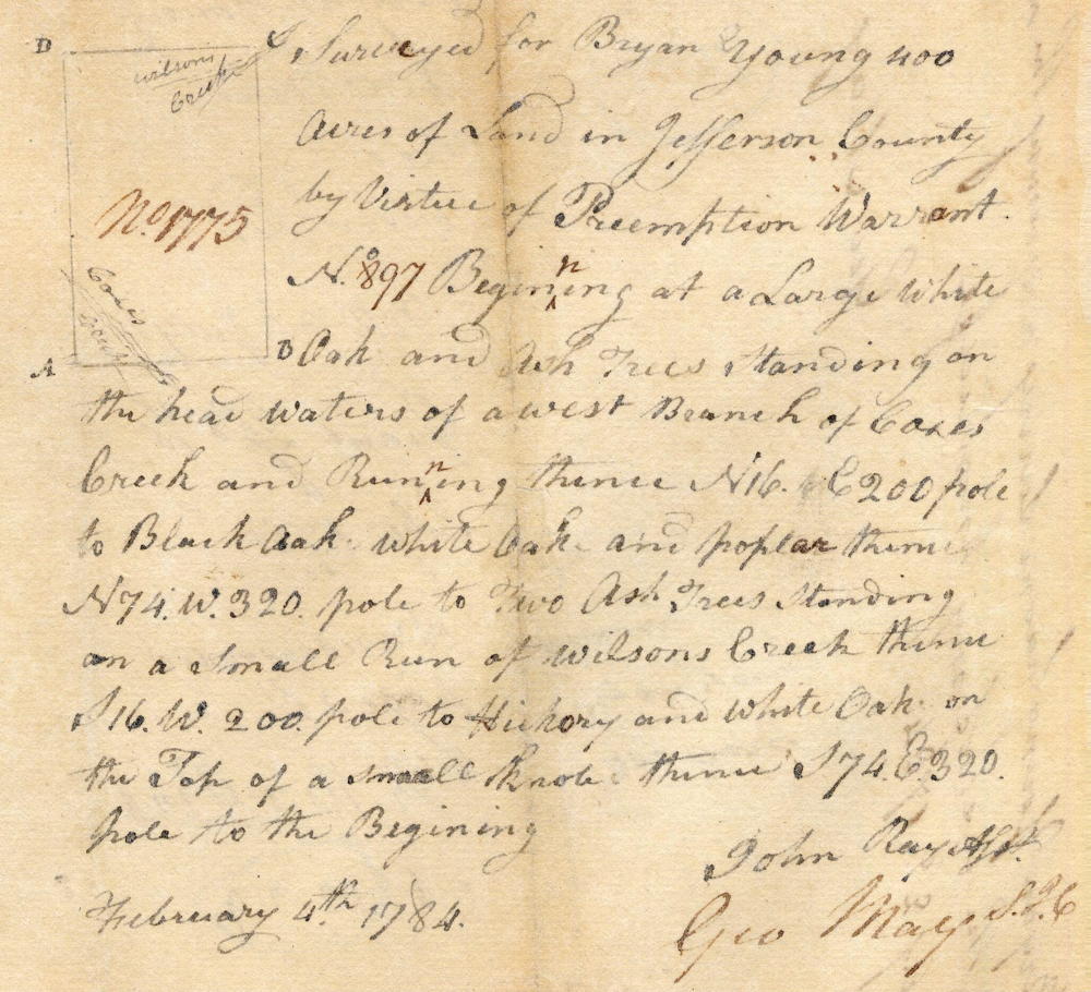
On 4 Feb 1784, John Ray surveyed 400 acres for Bryan Young located between the West Fork of Cox's Creek and Wilson's Creek. Young received his deed to the tract on 10 Jul 1785. We have rotated this plat drawing to orient it with the directions given in the survey description, with A being the starting corner. However, we are uncertain about the drawing's placement of the two creeks.
Survey
Surveyed for Bryan Young 400 acres of land in Jefferson County by virtue of preemption warrant No. 897. Beginning at a large white oak and ash trees standing on the head waters of a west branch of Cox's Creek and running thence North 16° East 200 poles to black oak, white oak, and poplar, thence North 74° West 320 poles to two ash trees standing on a small run of Wilson's Creek, thence South 16° West 200 poles to hickory and white oak on the top of a small knob, thence South 74° East 320 poles to the beginning. February 4th 1784. John Ray, surveyor.
Deed
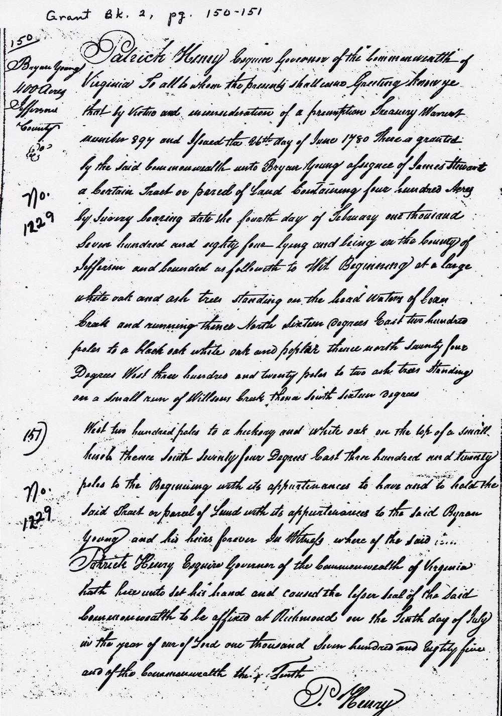
Virginia Grant Book 2, pages 150-151
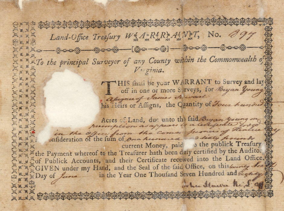
Patrick Henry Esquire, Governor of the Commonwealth of Virginia. To all to whom these presents shall come, greeting. Know ye that by virtue and in consideration of part of a land office treasury warrant number 897 and issued the 26th day of June 1780, there is granted by the said Commonwealth unto Bryan Young assignee of James Stewart a certain tract or parcel of land containing 400 acres by survey bearing date the 4th day of February 1784, lying and being in the county of Jefferson and bounded as followeth, to wit. Beginning at a large white oak and ash trees standing on the head waters of a west branch of Cox's Creek and running thence North 16° East 200 poles to black oak, white oak, and poplar, thence North 74° West 320 poles to two ash trees standing on a small run of Wilson's Creek, thence South 16° West 200 poles to hickory and white oak on the top of a small knob, thence South 74° East 320 poles to the beginning with its appurtenances to have and to hold the said tract or parcel of land with its appurtenances to the said Michael Horine and his heirs forever. In witness whereof the said Patrick Henry Esquire, Governor of the Commonwealth of Virginia, hath hereunto set his hand and caused the lesser seal of the said Commonwealth to be affixed at Richmond on the 10th day of July in the year of our Lord 1785, and of the Commonwealth the 10th. (signed) P. Henry
Warrant
If you, the reader, have an interest in any particular part of our county history, and wish to contribute to this effort, use the form on our Contact Us page to send us your comments about this, or any Bullitt County History page. We welcome your comments and suggestions. If you feel that we have misspoken at any point, please feel free to point this out to us.
The Bullitt County History Museum, a service of the Bullitt County Genealogical Society, is located in the county courthouse at 300 South Buckman Street (Highway 61) in Shepherdsville, Kentucky. The museum, along with its research room, is open 10 a.m. to 4 p.m. Monday through Friday. Saturday appointments are available by calling 502-921-0161 during our regular weekday hours. Admission is free. The museum, as part of the Bullitt County Genealogical Society, is a 501(c)3 tax exempt organization and is classified as a 509(a)2 public charity. Contributions and bequests are deductible under section 2055, 2106, or 2522 of the Internal Revenue Code. Page last modified: 21 Apr 2026 . Page URL: bullittcountyhistory.org/bchistory/1229-young.html