
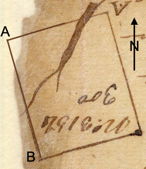
On 25 Jun 1784, Isaac Morrison surveyed 300 acres on a branch of Cedar Creek, on the south side of Salt River, and above the mouth of Floyd's Fork, for William Allen. Allen received his deed to the tract on 19 Jul 1786. This survey describes the tract as lying "50 poles below where the trace from Cox's Creek to Salt River ferry crosses it." The plat drawing shown here has been rotated to a more proper orientation.
Survey
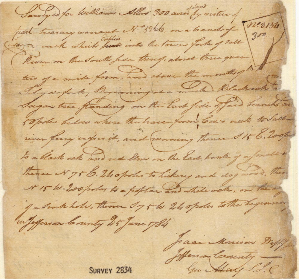
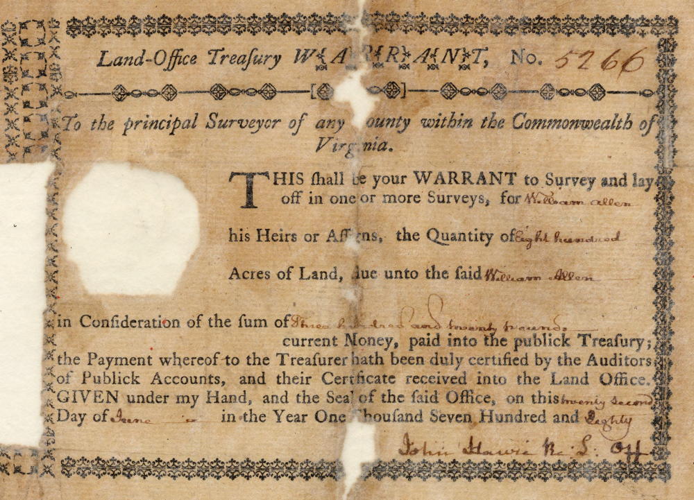
Surveyed for William Allen 300 acres of land by virtue of part of a treasury warrant number 5266 on a branch of Cedar Creek which empties into the town fork of Salt River on the southside thereof about three quarters of a mile from and above the mouth of Floyd's Fork, beginning at a marked black oak and sugar tree standing on the east side of said branch and 50 poles below where the trace from Cox's Creek to Salt River ferry crosses it, and running thence S 15° E 200 poles to a black oak and red elm on the east bank of a small run, thence N 75° E 240 poles to hickory and dogwood, thence N 15° W 200 poles to a poplar and white oak, on the edge of a sink hole, thence S 75° W 240 poles to the beginning in Jefferson County. 25 June 1784. Isaac Morrison, surveyor.
Deed
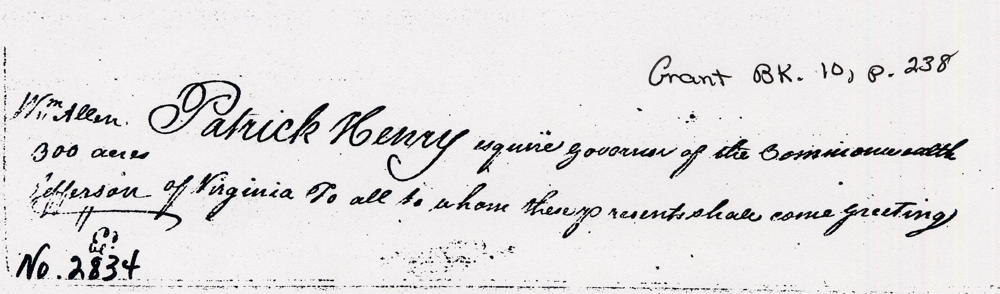
Virginia Grant Book 10, pages 238-9
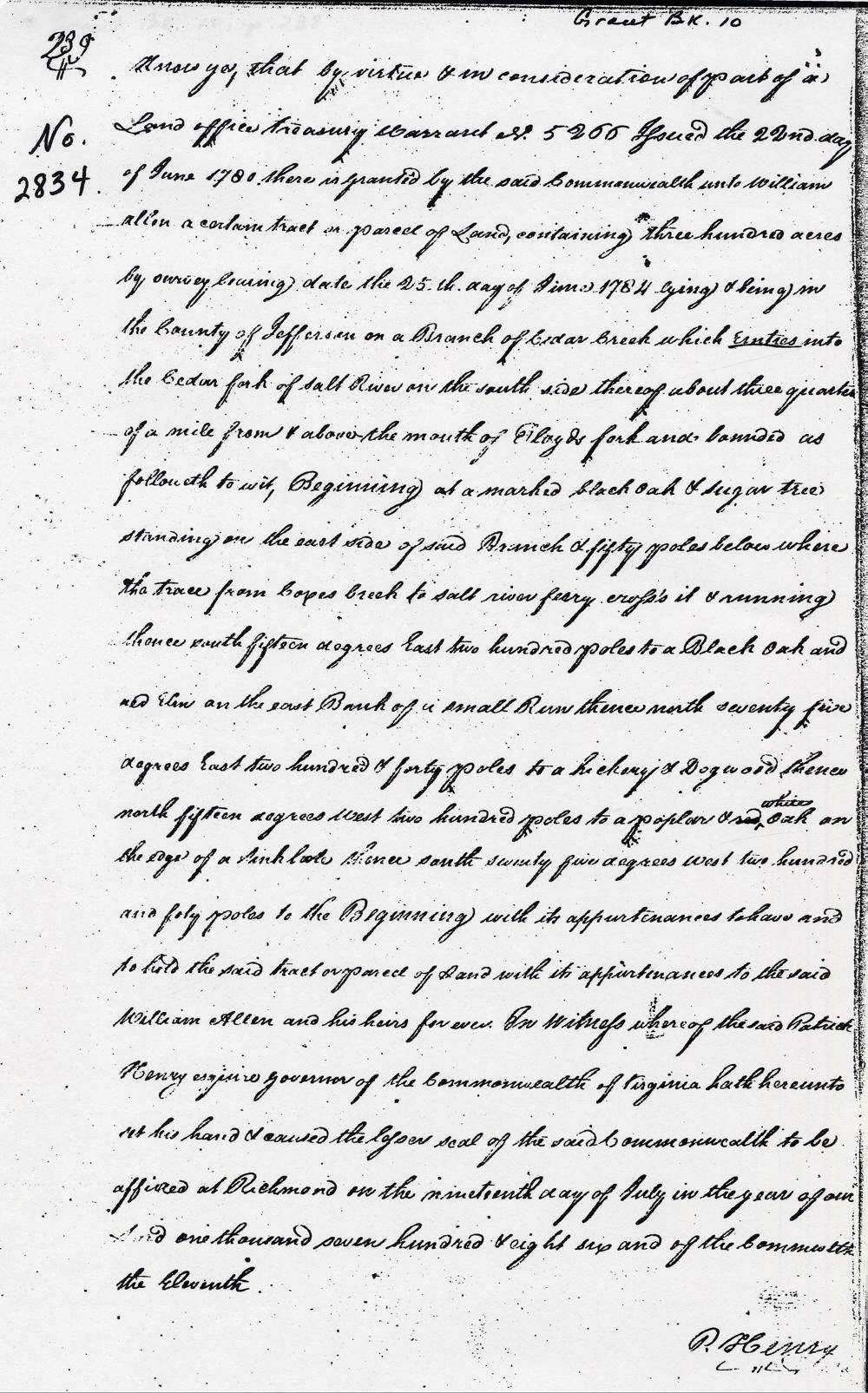
Patrick Henry Esquire, governor of the Commonwealth of Virginia, to all to whom these presents shall come, greeting. Know ye by virtue and in consideration of part of a land office treasury warrant number 5266, issued the 22nd day of June 1780, there is granted by the said Commonwealth unto William Allen a certain tract or parcel of land containing 300 acres by survey bearing date the 25th day of June 1784, lying and being in the county of Jefferson on a branch of Cedar Creek which enters into the town fork of Salt River on the south side thereof about three-quarters of a mile from & above the mouth of Floyd's fork and bounded as followeth, to wit. Beginning at a marked black oak and sugar tree standing on the east side of said branch and 50 poles below where the trace from Cox's Creek to Salt River ferry crosses it, and running thence South 15° East 200 poles to a black oak and red elm on the east bank of a small run, thence North 75° East 240 poles to hickory and dogwood, thence North 15° West 200 poles to a poplar and white oak, on the edge of a sink hole, thence South 75° West 240 poles to the beginning with its appurtenances to have and to hold the said tract or parcel of land with its appurtenances to the said William Allen and his heirs forever. In witness whereof the said Patrick Henry Esquire, governor of the Commonwealth of Virginia, hath hereunto set his hand and caused the lesser seal of the said Commonwealth to be affixed at Richmond on the 19th day of July in the year of our Lord 1786, and of the Commonwealth the 11th. (signed) P. Henry
Warrant
If you, the reader, have an interest in any particular part of our county history, and wish to contribute to this effort, use the form on our Contact Us page to send us your comments about this, or any Bullitt County History page. We welcome your comments and suggestions. If you feel that we have misspoken at any point, please feel free to point this out to us.
The Bullitt County History Museum, a service of the Bullitt County Genealogical Society, is located in the county courthouse at 300 South Buckman Street (Highway 61) in Shepherdsville, Kentucky. The museum, along with its research room, is open 10 a.m. to 4 p.m. Monday through Friday. Saturday appointments are available by calling 502-921-0161 during our regular weekday hours. Admission is free. The museum, as part of the Bullitt County Genealogical Society, is a 501(c)3 tax exempt organization and is classified as a 509(a)2 public charity. Contributions and bequests are deductible under section 2055, 2106, or 2522 of the Internal Revenue Code. Page last modified: 21 Apr 2026 . Page URL: bullittcountyhistory.org/bchistory/2834-allen.html