
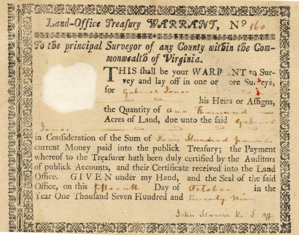
On 21 Feb 1783 a Mr. Floyd surveyed 2500 acres for Gabriel Jones that was located between the fish pools and the knobs of Salt River in northern Bullitt County. This was #17 on the 1811 plat drawing by James Shanks, Bullitt County Surveyor, which is described on another page. Jones received a deed for this tract on 2 Dec 1785.
Jones conveyed ownership of the land to his son-in-law, John Hawkins, in 1799.
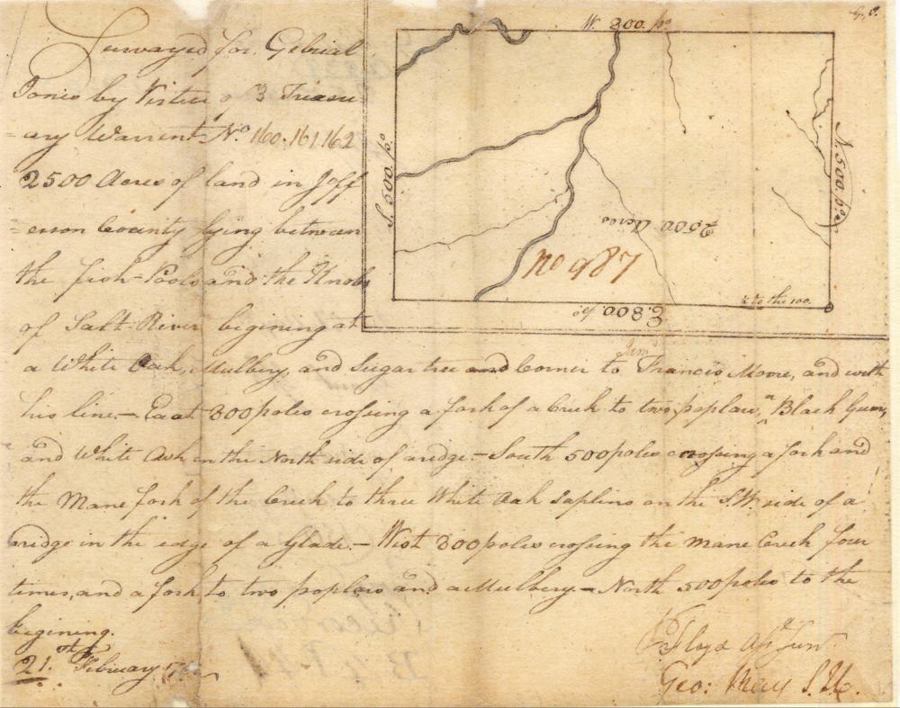
Survey
Surveyed for Gabriel Jones by virtue of 3 treasury warrants No. 160, 161, 162, 2500 acres of land in Jefferson County lying between the fish pools and the Knobs of Salt River, beginning at a white oak, mulberry and sugar tree and corner to Francis Moore and with his line East 800 poles crossing a fork of a creek to two poplars, a black gum and white ash on the north side of a ridge, South 500 poles crossing a fork and the main fork of the creek to three white oak saplings on the SW side of a ridge in the edge of a glade, West 800 poles crossing the main creek four times and a fork to two poplars and a mulberry, North 500 poles to the beginning. 21 February 1783. ? Floyd surveyor.
Deed
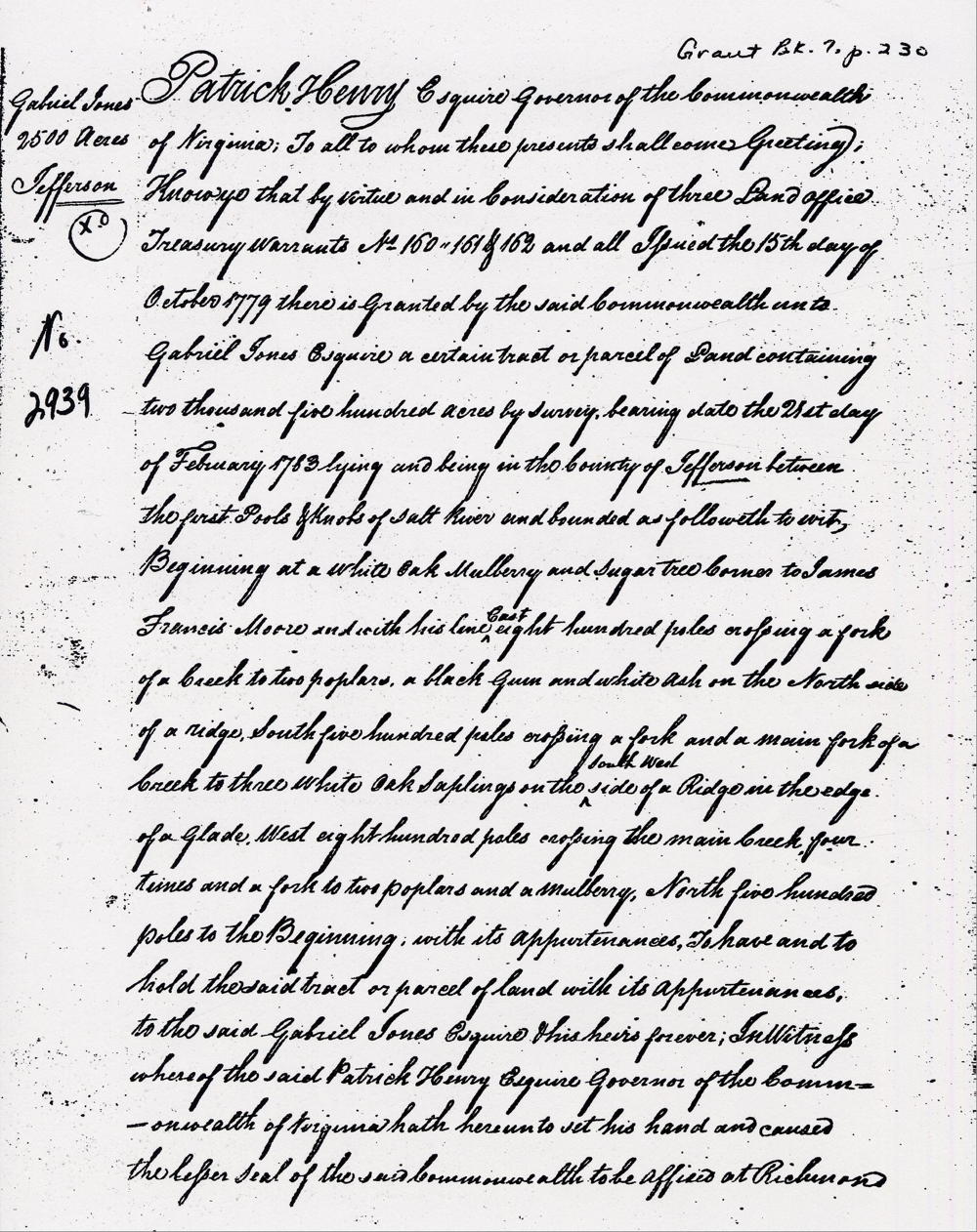
Virginia Grant Book 7, pages 230-231
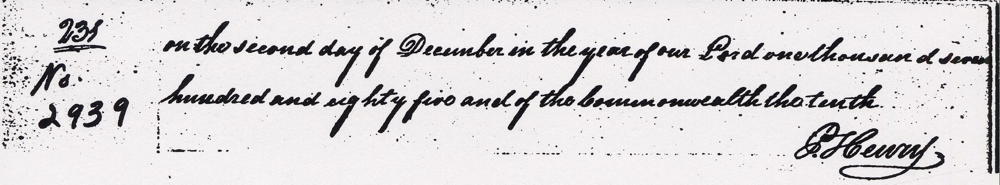
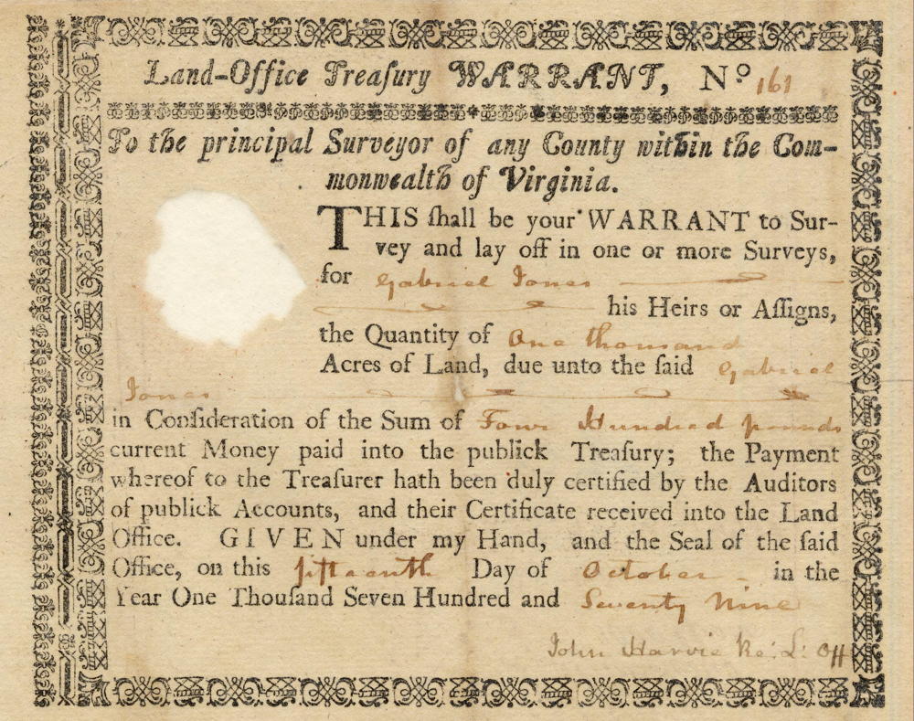
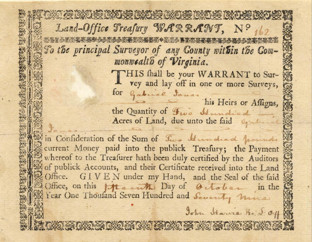
Patrick Henry Esquire, Governor of the Commonwealth of Virginia, to all to whom these presents shall come, greeting. Know ye that by virtue and in consideration of three land office treasury warrants No. 160, 161, & 162 and all issued the 15th day of October 1779, there is granted by the said Commonwealth unto Gabriel Jones Esquire a certain tract or parcel of land containing two thousand five hundred acres by survey bearing date the 21st day of February 1783, lying and being in the county of Jefferson between the first pools & knobs of Salt River and bounded as followeth to wit, beginning at a white oak, mulberry and sugar tree and corner to James Francis Moore and with his line East 800 poles crossing a fork of a creek to two poplars, a black gum and white ash on the north side of a ridge, South 500 poles crossing a fork and the main fork of the creek to three white oak saplings on the south west side of a ridge in the edge of a glade, West 800 poles crossing the main creek four times and a fork to two poplars and a mulberry, North 500 poles to the beginning with its appurtenances to have and to hold the said tract or parcel of land with its appurtenances to the said Gabriel Jones Esquire & his heirs forever. In witness whereof the said Patrick Henry Esquire, Governor of the Commonwealth of Virginia, hath hereunto set his hand and caused the lesser seal of the said Commonwealth to be affixed at Richmond on the second day of December in the year of our Lord one thousand seven hundred and eighty five and of the Commonwealth the tenth. (signed) P. Henry
Warrants
If you, the reader, have an interest in any particular part of our county history, and wish to contribute to this effort, use the form on our Contact Us page to send us your comments about this, or any Bullitt County History page. We welcome your comments and suggestions. If you feel that we have misspoken at any point, please feel free to point this out to us.
The Bullitt County History Museum, a service of the Bullitt County Genealogical Society, is located in the county courthouse at 300 South Buckman Street (Highway 61) in Shepherdsville, Kentucky. The museum, along with its research room, is open 10 a.m. to 4 p.m. Monday through Friday. Saturday appointments are available by calling 502-921-0161 during our regular weekday hours. Admission is free. The museum, as part of the Bullitt County Genealogical Society, is a 501(c)3 tax exempt organization and is classified as a 509(a)2 public charity. Contributions and bequests are deductible under section 2055, 2106, or 2522 of the Internal Revenue Code. Page last modified: 21 Apr 2026 . Page URL: bullittcountyhistory.org/bchistory/2939-jones.html