
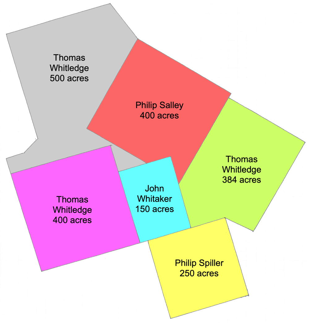
On 6 Dec 1782, Isaac Cox surveyed 250 acres of land for Phillip Spiller located on the West Fork of Cox's Creek. The deed for this tract was issued to Spiller on 2 Dec 1785. Spiller, who lived in Virginia, sold the tract to Thomas Whitledge on 12 Nov 1790.
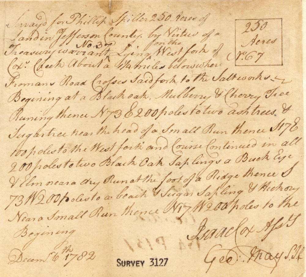
Survey
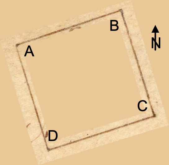
Surveyed for Phillip Spiller 250 acres of land in Jefferson County by virtue of a treasury warrant No. 37, lying on the west fork of Cox's Creek about 1 1/4 miles below where Froman's Road crosses said fork to the saltworks. Beginning at [A] a black oak, mulberry & cherry tree, running thence N 73° E 200 poles to [B] two ash trees & sugar tree near the head of a small run, thence S 17° E 100 poles to the west fork and course continued in all 200 poles to [C] two black oak saplings, a buckeye & elm near a dry run at the foot of a ridge, thence S 73° W 200 poles to [D] a beech & sugar sapling & hickory near a small run, thence N 17° W 200 poles to the beginning. Isaac Cox, assistant surveyor. December 6th 1782.
Deed
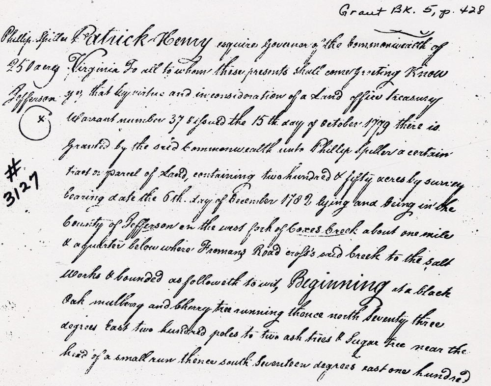
Virginia Grant Book 5, pages 428-9
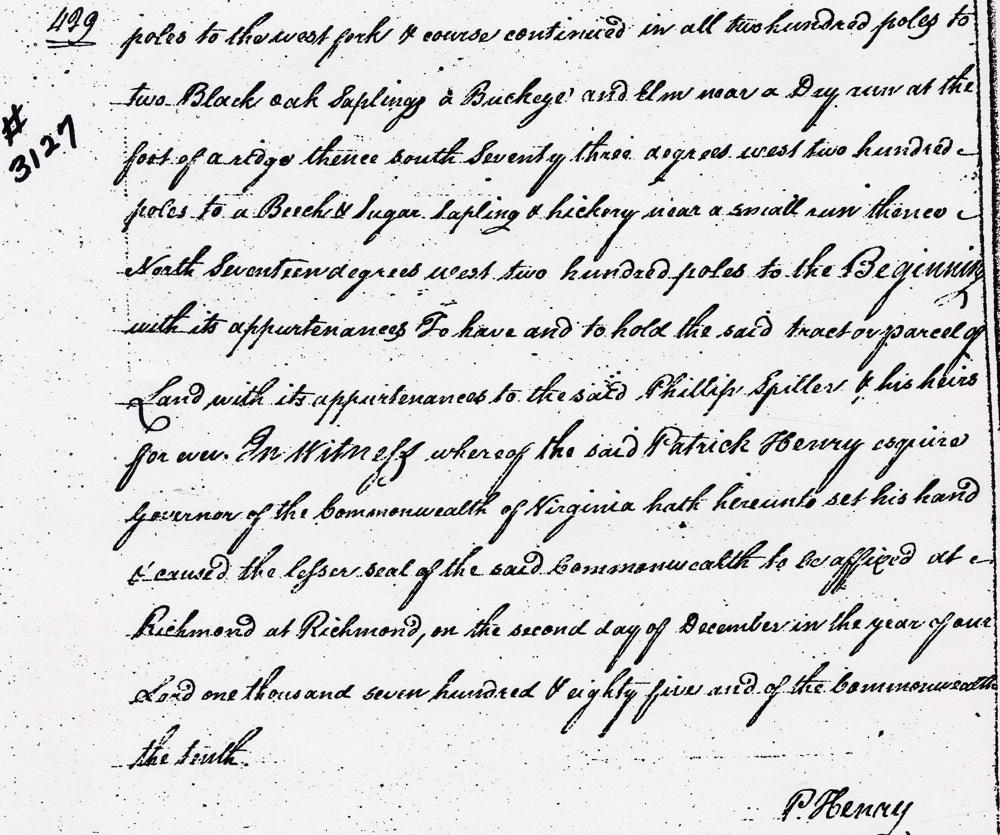
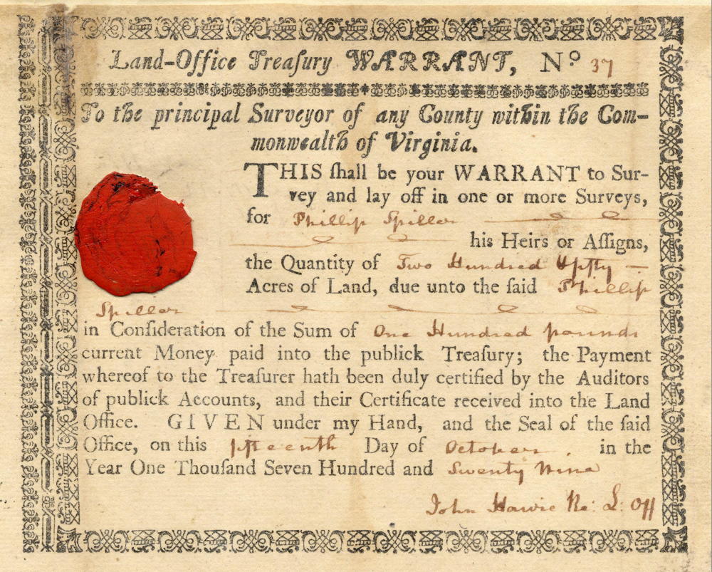
Patrick Henry Esquire, Governor of the Commonwealth of Virginia, to all to whom these presents shall come, greeting. Know ye that by virtue and in consideration of a land office treasury warrant number 37 issued the 15th day of October 1779 there is granted by the said Commonwealth unto Phillip Spiller a certain tract or parcel of land containing 250 acres by survey bearing date the 6th day of December 1782, lying and being in the County of Jefferson on the west fork of Cox's Creek about one mile and a quarter below where Froman's Road crosses said creek to the salt works and bounded as followeth to wit. Beginning at a black oak, mulberry & cherry tree, running thence North 73° East 200 poles to two ash trees & sugar tree near the head of a small run, thence South 17° East 100 poles to the west fork and course continued in all 200 poles to two black oak saplings, a buckeye & elm near a dry run at the foot of a ridge, thence South 73° West 200 poles to a beech & sugar sapling & hickory near a small run, thence North 17° West 200 poles to the beginning with it appurtenances to have and to hold the said tract or parcel of land with its appurtenances to the said Phillip Spiller & his heirs forever. In witness whereof the said Patrick Henry Esquire, Governor of the Commonwealth of Virginia, hath hereunto set his hand and caused the lesser seal of the said Commonwealth to be affixed at Richmond on the 2nd day of December in the year of our Lord 1785 and of the Commonwealth the tenth. (signed) P. Henry
Warrant
If you, the reader, have an interest in any particular part of our county history, and wish to contribute to this effort, use the form on our Contact Us page to send us your comments about this, or any Bullitt County History page. We welcome your comments and suggestions. If you feel that we have misspoken at any point, please feel free to point this out to us.
The Bullitt County History Museum, a service of the Bullitt County Genealogical Society, is located in the county courthouse at 300 South Buckman Street (Highway 61) in Shepherdsville, Kentucky. The museum, along with its research room, is open 10 a.m. to 4 p.m. Monday through Friday. Saturday appointments are available by calling 502-921-0161 during our regular weekday hours. Admission is free. The museum, as part of the Bullitt County Genealogical Society, is a 501(c)3 tax exempt organization and is classified as a 509(a)2 public charity. Contributions and bequests are deductible under section 2055, 2106, or 2522 of the Internal Revenue Code. Page last modified: 21 Apr 2026 . Page URL: bullittcountyhistory.org/bchistory/3127-spiller.html