
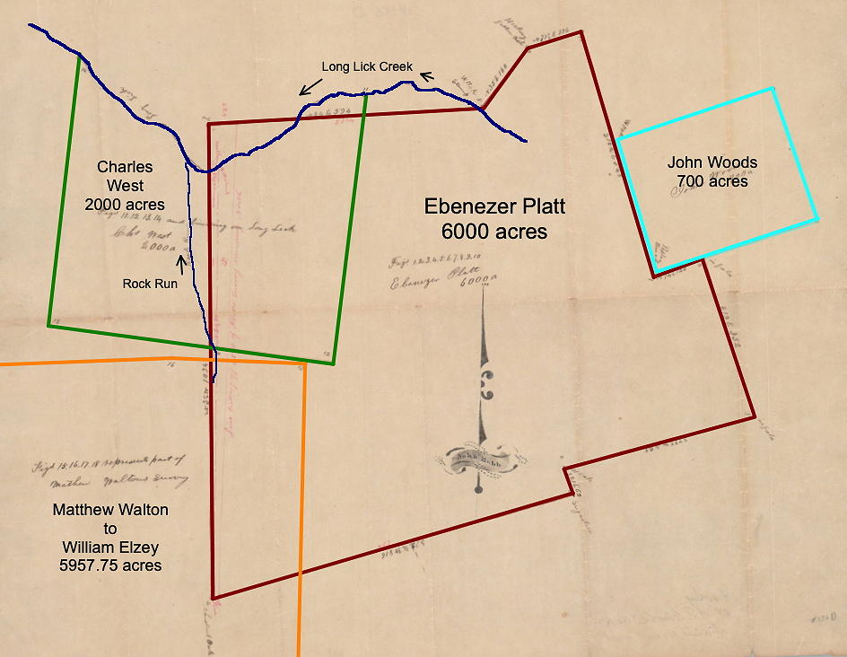
This survey for Ebenezer Platt is shown on the drawing below that is based on a later plat drawing done by John Robb. The drawing also shows the Platt tracts relation to three other land patents: John Wood's 700 acres; Charles West's 2000 acres; and a 5957.75 acre tract surveyed for Matthew Walton. As you can see, these tracts all lay along or south of Long Lick Creek.
As with many of the early land transactions, this paper trail passed through many hands beginning with David Anderson, and continuing with Ebenezer Platt, John Lawrence, and eventually Samuel Allison as you will see below.
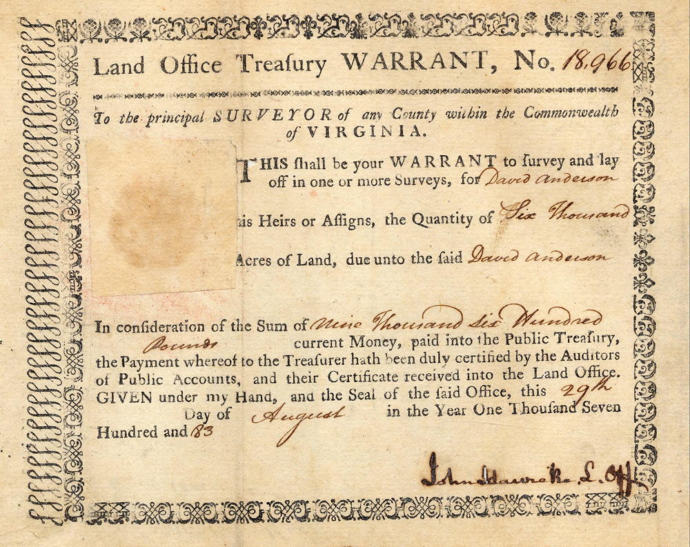
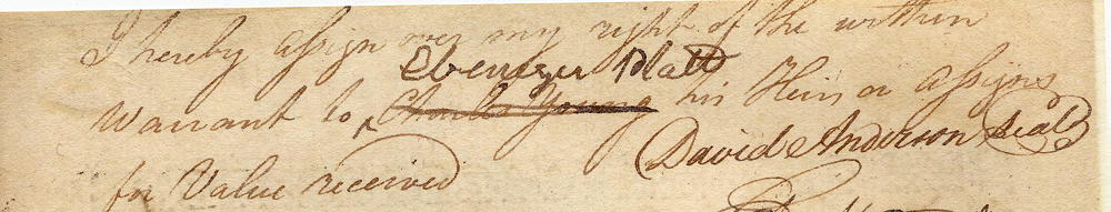
David Anderson obtained Virginia Treasury Warrant No. 18966 on 29 Aug 1783. He then assigned that warrant to Ebenezer Platt by endorsing it on the back as shown below.
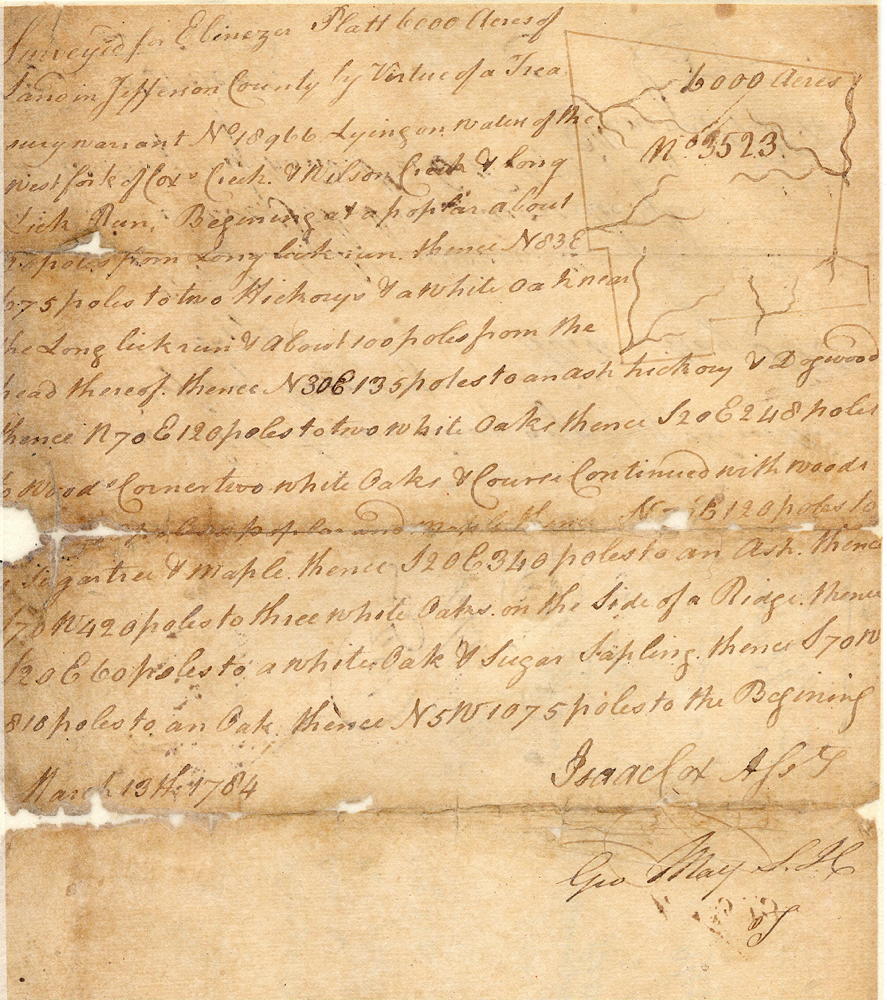
Platt had 6000 acres surveyed in what would become eastern Bullitt County. The survey was done by Isaac Cox on 13 Mar 1784.
Survey
Surveyed for Ebenezer Platt 6000 acres of land in Jefferson County, by virtue of a treasury warrant No. 18966, lying on waters of the west fork of Cox's Creek and Wilson's Creek and Long Lick Run. Beginning at a poplar about 20 poles from Long Lick Run, thence N 83° E 675 poles to two hickories and white oak near the Long Lick Run and about 100 poles from the head thereof, thence N 30° E 135 poles to an ash, hickory and dogwood, thence N 70° E 120 poles to two white oaks, thence S 20° E 248 poles to Wood's corner, two white oaks, course continue with Wood's line 548 poles to a poplar and maple, thence N 70° E 120 poles to a sugar tree and maple, thence S 20° E 340 poles to an ash, thence S 70° W 420 poles to three white oaks on the side of a ridge, thence S 20° E 60 poles to a white oak and sugar sapling, thence S 70° W 810 poles to an oak, thence N 5° W 1075 poles to the beginning. March 13th 1784. Isaac Cox, surveyor
I do hereby assign over all my right to the within survey to John Lawrence for value received as witness my hand this 6th September 1784. (signed) Ebenezer Platt.
Teste Benjamin Stevens
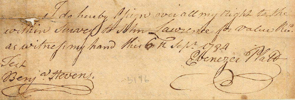
Then, on 6 Sep 1784, Platt assigned the survey to John Lawrence by endorsing it on the back as shown above.
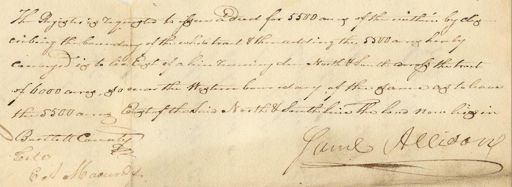
John Lawrence obtained his deed to the survey on 13 Jun 1786. However, after repeatedly failing to pay taxes on the land, the majority of it was sold to Samuel Allison for the taxes due.
Deed
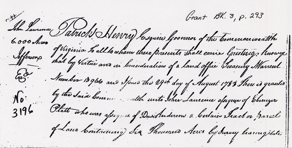
Virginia Grant Book 3, Pages 293-4
Patrick Henry, Esquire, governor of the Commonwealth of Virginia to all to whom these presents shall come, greeting. Know ye that by virtue, and in consideration of a land office treasury warrant number 18966 and issued the 29th day of August 1783, there is granted by the said Commonwealth unto John Lawrence assignee of Ebeneezer Platt, who was assignee of David Anderson, a certain tract or parcel of land containing 6000 acres by survey bearing date the 13th day of March 1784, lying and being in the county of Jefferson on the waters of the West Fork of Cox's Creek and Wilson Creek and bounded as followeth, to wit.
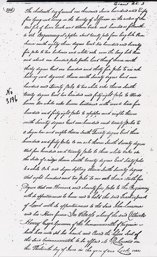
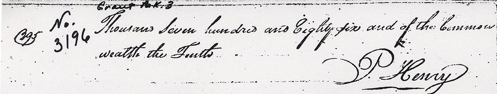
Beginning at a poplar about 20 poles from Long Lick Run, thence N 83° E 675 poles to two hickories and white oak near the Long Lick Run and about 100 poles from the head thereof, thence N 30° E 135 poles to an ash, hickory and dogwood, thence N 70° E 120 poles to two white oaks, thence S 20° E 248 poles to Wood's corner, two white oaks, course continue with Wood's line 548 poles to a poplar and maple, thence N 70° E 120 poles to a sugar tree and maple, thence S 20° E 340 poles to an ash, thence S 70° W 420 poles to three white oaks on the side of a ridge, thence S 20° E 60 poles to a white oak and sugar sapling, thence S 70° W 810 poles to an oak, thence N 5° W 1075 poles to the beginning with its appurtenances to have and to hold, the said tract or parcel of land with its appurtenances to the said John Laurence and his heirs forever. In witness whereof the said Patrick Henry, Esquire, governor of the Commonwealth of Virginia hath here unto set his hand and caused the lesser seal of the said Commonwealth to be affixed at Richmond on the 13th day of June in the year of our Lord 1786, and of the Commonwealth the 10th. (signed) P. Henry
If you, the reader, have an interest in any particular part of our county history, and wish to contribute to this effort, use the form on our Contact Us page to send us your comments about this, or any Bullitt County History page. We welcome your comments and suggestions. If you feel that we have misspoken at any point, please feel free to point this out to us.
The Bullitt County History Museum, a service of the Bullitt County Genealogical Society, is located in the county courthouse at 300 South Buckman Street (Highway 61) in Shepherdsville, Kentucky. The museum, along with its research room, is open 10 a.m. to 4 p.m. Monday through Friday. Saturday appointments are available by calling 502-921-0161 during our regular weekday hours. Admission is free. The museum, as part of the Bullitt County Genealogical Society, is a 501(c)3 tax exempt organization and is classified as a 509(a)2 public charity. Contributions and bequests are deductible under section 2055, 2106, or 2522 of the Internal Revenue Code. Page last modified: 21 Apr 2026 . Page URL: bullittcountyhistory.org/bchistory/3196-platt.html