
On 31 Oct 1785, John Helm surveyed three tracts of land for John May which adjoined one another and were located on the south side of Salt River next to the Ohio River in Jefferson County. This land would later be part of Nelson and then Hardin counties. All three lay across Salt River from Bullitt County.
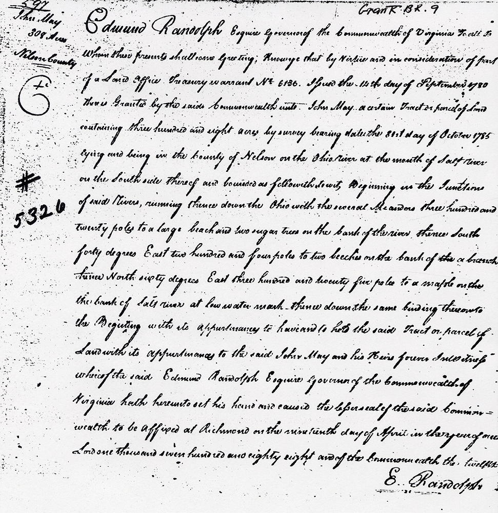
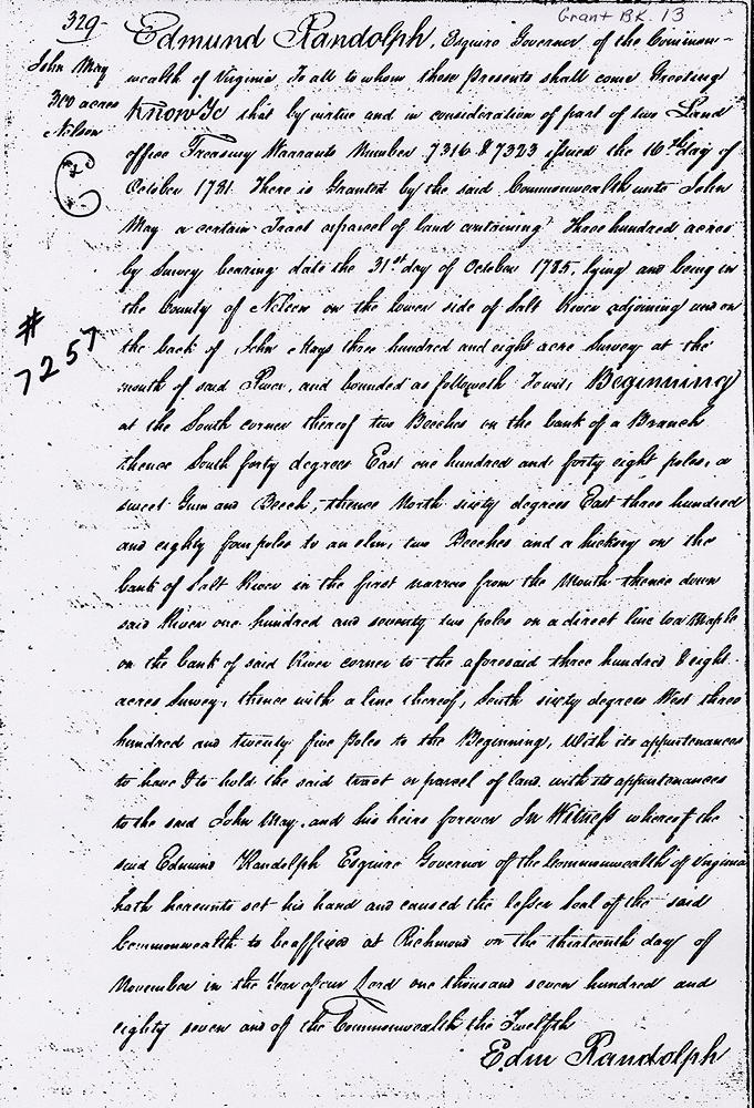
The first (Virginia Grant #5326; 308 acres) began at the junction of the Ohio and Salt Rivers. The second (#7257; 300 acres) adjoined the first and extended up Salt River. The third (#5337; 100 acres) adjoined the second continuing upstream along the river.
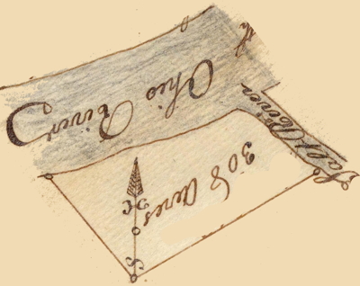
Survey - VA-5326
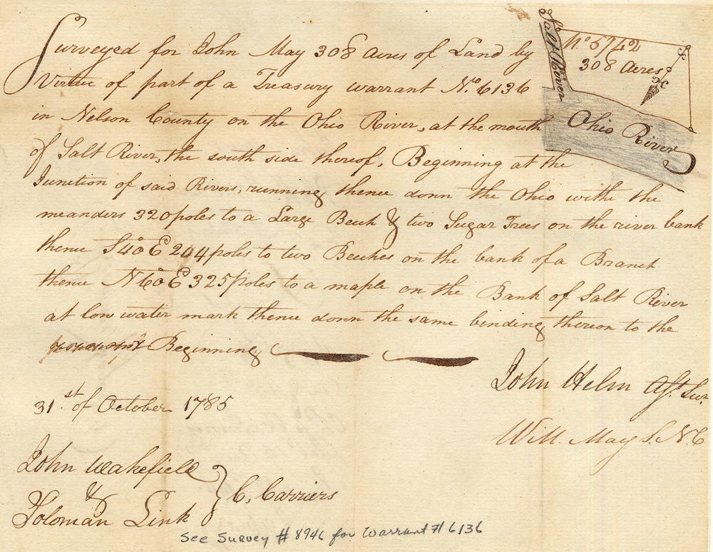
Surveyed for John May 308 acres of land by virtue of part of a treasury warrant No. 6136 in Nelson County on the Ohio River at the mouth Salt River, the south side thereof. Beginning at the junction of said rivers, running thence down the Ohio with the meanders 320 poles to a large beech and two sugar trees on the river bank, thence S 40° E 204 poles to two beeches on the bank of a branch, thence N 60° E 325 poles to a maple on the bank of Salt River at low water mark, thence down the same binding thereon to the beginning. 31st October 1785. John Helm, surveyor.
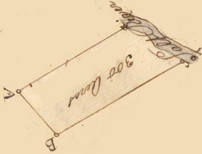
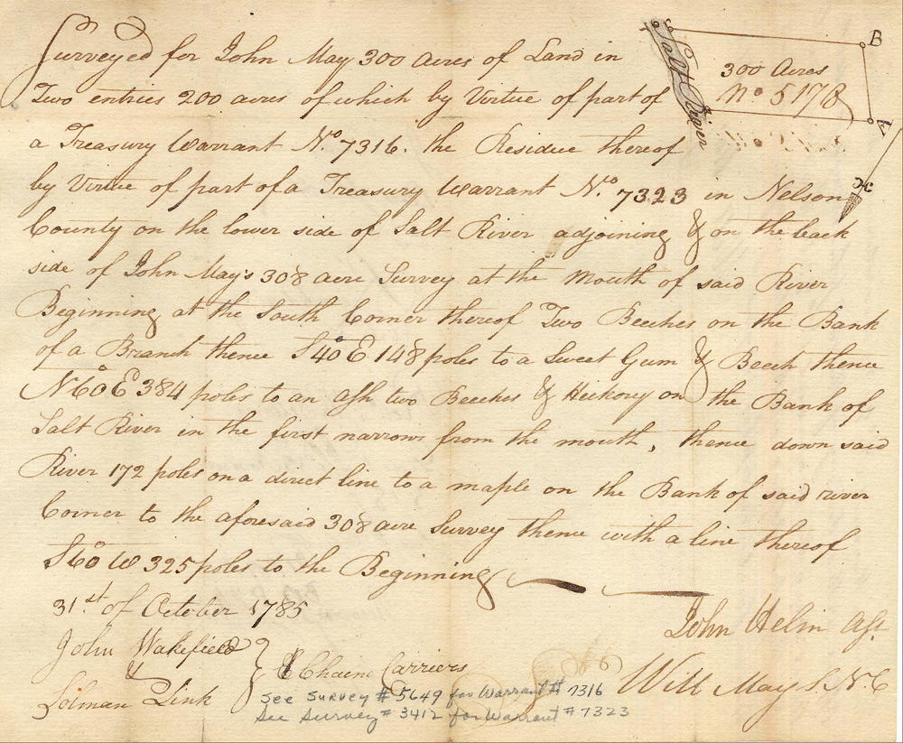
Survey - VA-7257
Surveyed for John May 300 acres of land in two entries, 200 of which by virtue of part of a treasury warrant No. 7316, the residue thereof by virtue of part of a treasury warrant No. 7323 in Nelson County on the lower side of Salt River adjoining and on the backside of John May's 308 acre survey at the mouth of said river. Beginning at the south corner thereof, two beeches on the bank of a branch, thence S 40° E 148 poles to a sweet gum and beech, thence N 60° E 384 poles to an ash, two beeches and hickory on the bank of Salt River in the first narrow from the mouths, thence down said river 172 poles on a direct line to a maple on the bank of said river, corner to the aforesaid 308 acre survey, thence with a line thereof S 60° W 325 poles to the beginning. 31st October 1785. John Helm, surveyor.
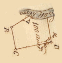
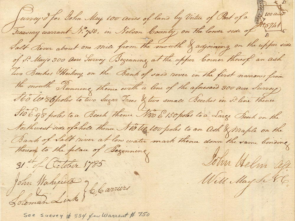
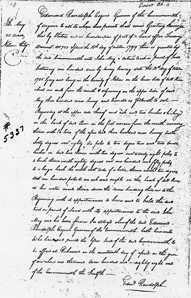
Survey - VA-5337
Surveyed for John May 100 acres of land by virtue of part of a treasury warrant No. 750 in Nelson County on the lower side of Salt River about one mile from the mouth and adjoining on the upper side os said May's 300 acre survey beginning at the upper corner thereof, an ash, two beeches and hickory on the bank of said river in the first narrows from the mouth, running thence with a line of the aforesaid 300 acre survey S 60° W 86 poles to two sugar trees and two small beeches in said line, thence S 10° E 98 poles to a beech, thence N 80° E 150 poles to a large beech on the northwest side of a hill, thence N 10° W 100 poles to an ash and maple on the bank of Salt River at low water mark, thence down the same binding thereon to the place of beginning. 31st of October 1785. John Helm, surveyor.
Deeds
If you, the reader, have an interest in any particular part of our county history, and wish to contribute to this effort, use the form on our Contact Us page to send us your comments about this, or any Bullitt County History page. We welcome your comments and suggestions. If you feel that we have misspoken at any point, please feel free to point this out to us.
The Bullitt County History Museum, a service of the Bullitt County Genealogical Society, is located in the county courthouse at 300 South Buckman Street (Highway 61) in Shepherdsville, Kentucky. The museum, along with its research room, is open 10 a.m. to 4 p.m. Monday through Friday. Saturday appointments are available by calling 502-921-0161 during our regular weekday hours. Admission is free. The museum, as part of the Bullitt County Genealogical Society, is a 501(c)3 tax exempt organization and is classified as a 509(a)2 public charity. Contributions and bequests are deductible under section 2055, 2106, or 2522 of the Internal Revenue Code. Page last modified: 21 Apr 2026 . Page URL: bullittcountyhistory.org/bchistory/5326-5337-7257-johnmay.html