
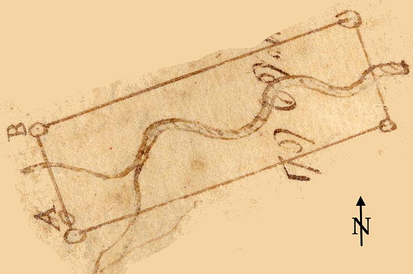
On 3 Jan 1787, Adam Shepherd surveyed 300 acres for John Carr along Crooked Creek in what was then Nelson County. This drawing shows the directional shape of this tract. He sold 200 of the acres to Evan Moore in 1798.
Survey
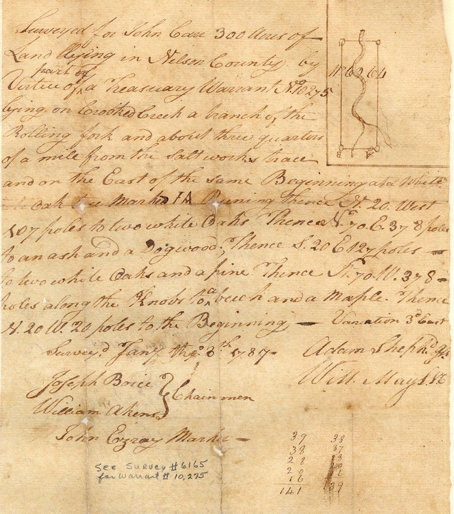
Surveyed for John Carr 300 acres of land lying in Nelson County by virtue of part of a land office treasury warrant No. 10275 lying on Crooked Creek, a branch of the Rolling Fork, and about three-quarters of a mile from the Saltworks Trace on the east of the same.
Beginning at a white oak tree marked I.A., running North 20° West 107 poles to two white oaks, thence North 70° East 378 poles to an ash and dogwood, thence South 20° East 127 poles to two white oaks and pine, thence South 70° West 378 poles along the knobs to a beech and maple, thence North 20° West 20 poles to the beginning - variation 3° East. Surveyed January 3rd 1787 by Adam Shepherd. Joseph Boice and William Akers, chainmen; John Essary, marker.
Deed
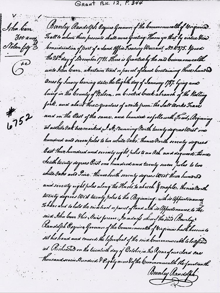
Virginia Grant Book 12, Page 344
Beverley Randolph Esquire, Governor of the Commonwealth of Virginia, to all to whom these presents shall come, greeting. Know ye that by virtue and in consideration of part of a land office treasury warrant No. 10275 issued the 24th day of December 1781, there is granted by the said Commonwealth unto John Carr a certain tract or parcel of land containing three hundred acres by survey bearing date the eighth day of January 1787, lying and being in the County of Nelson on Crooked Creek, a branch of the Rolling Fork, and about three-quarters of a mile from the Saltworks Trace, and on the east of the same, and bounded as followeth, to wit.
Beginning at a white oak tree marked I.A., running North 20° West 107 poles to two white oaks, thence North 70° East 378 poles to an ash and dogwood, thence South 20° East 127 poles to two white oaks and pine, thence South 70° West 378 poles along the knobs to a beech and maple, thence North 20° West 20 poles to the beginning with its appurtenances.
To have and to hold the said tract or parcel of land with its appurtenances to the said John Carr, his heirs forever. In witness whereof the said Beverley Randolph Esquire, Governor of the Commonwealth of Virginia, hath hereunto set his hand and caused the lesser seal of the said Commonwealth to be affixed at Richmond on the 20th day of October in the year of our Lord 1789, and of the Commonwealth the 14th. (signed) Beverley Randolph
If you, the reader, have an interest in any particular part of our county history, and wish to contribute to this effort, use the form on our Contact Us page to send us your comments about this, or any Bullitt County History page. We welcome your comments and suggestions. If you feel that we have misspoken at any point, please feel free to point this out to us.
The Bullitt County History Museum, a service of the Bullitt County Genealogical Society, is located in the county courthouse at 300 South Buckman Street (Highway 61) in Shepherdsville, Kentucky. The museum, along with its research room, is open 10 a.m. to 4 p.m. Monday through Friday. Saturday appointments are available by calling 502-921-0161 during our regular weekday hours. Admission is free. The museum, as part of the Bullitt County Genealogical Society, is a 501(c)3 tax exempt organization and is classified as a 509(a)2 public charity. Contributions and bequests are deductible under section 2055, 2106, or 2522 of the Internal Revenue Code. Page last modified: 21 Apr 2026 . Page URL: bullittcountyhistory.org/bchistory/6752-carr.html