
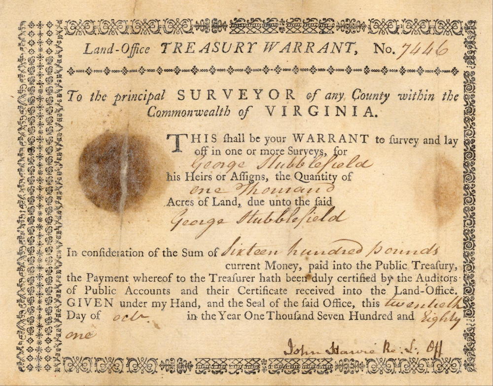
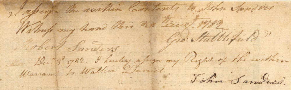
This patent was based on a land office treasury warrant originally issued to George Stubblefield who signed it over to John Sanders in August 1782. Sanders then signed it over to Walker Daniel in December. After Walker Daniel was killed by Indians, Robert Daniel inherited the warrant and used it to have Robert Breckinridge survey 505 acres on 2 Nov 1786 in what became far western Bullitt County. It lay adjacent to the tracts surveyed for Ben Johnston and John May, and stretched northward to cross Knob Creek. A deed was issued for the tract on 27 Feb 1790.
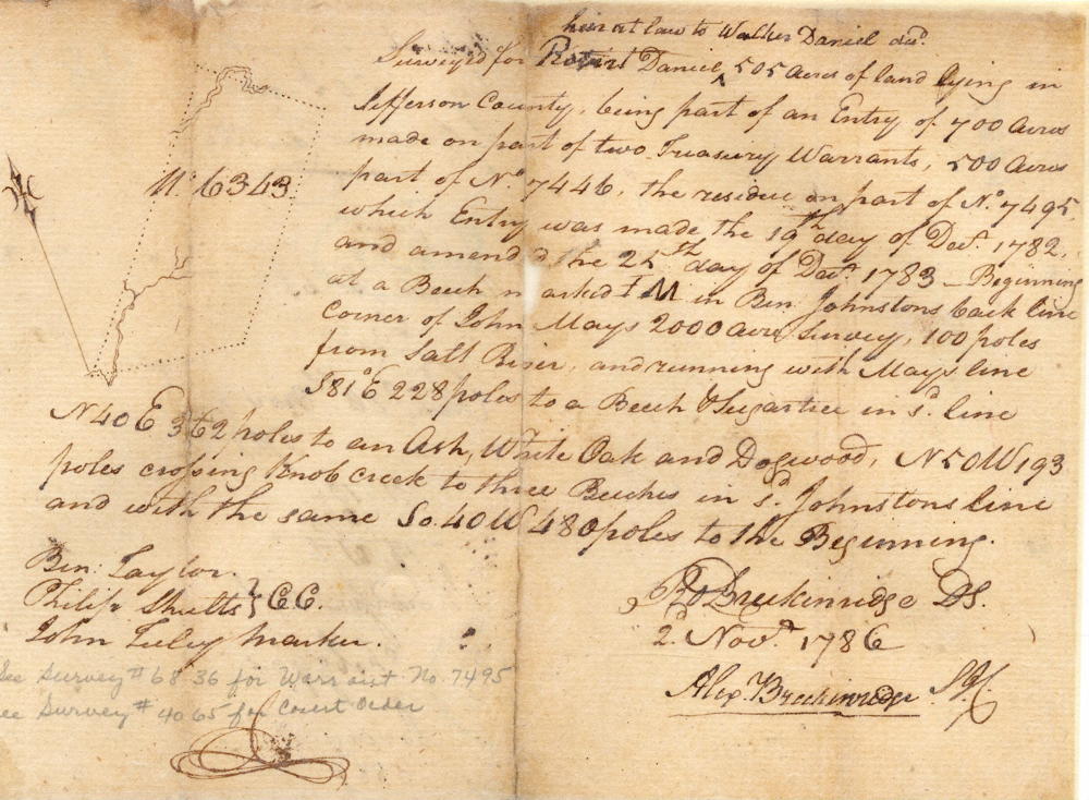
Survey
Surveyed for Robert Daniel, heir at law to Walker Daniel deceased, 505 acres of land lying in Jefferson County, being part of an entry of 700 acres made on part of two treasury warrants, 500 acres part of No. 7446, the residue on part of No. 7495, which entry was made the 19th day of December 1782 and amended the 25th day of December 1783. Beginning at a beech marked I.M. in Ben Johnston's back line, corner of John May's 2000 acre survey, 100 poles from Salt River, and running with May's line S 81° E 228 poles to a beech & sugar tree in said line, N 40° E 362 poles to an ash, white oak and dogwood, N 50° W 193 poles crossing Knob Creek to three beeches in said Johnston's line, and with the same S 40° W 480 poles to the beginning. Robert Breckinridge, surveyor. 2 November 1786. Ben Taylor & Philip Shults, chain carriers. John Tuley, marker.
Deed
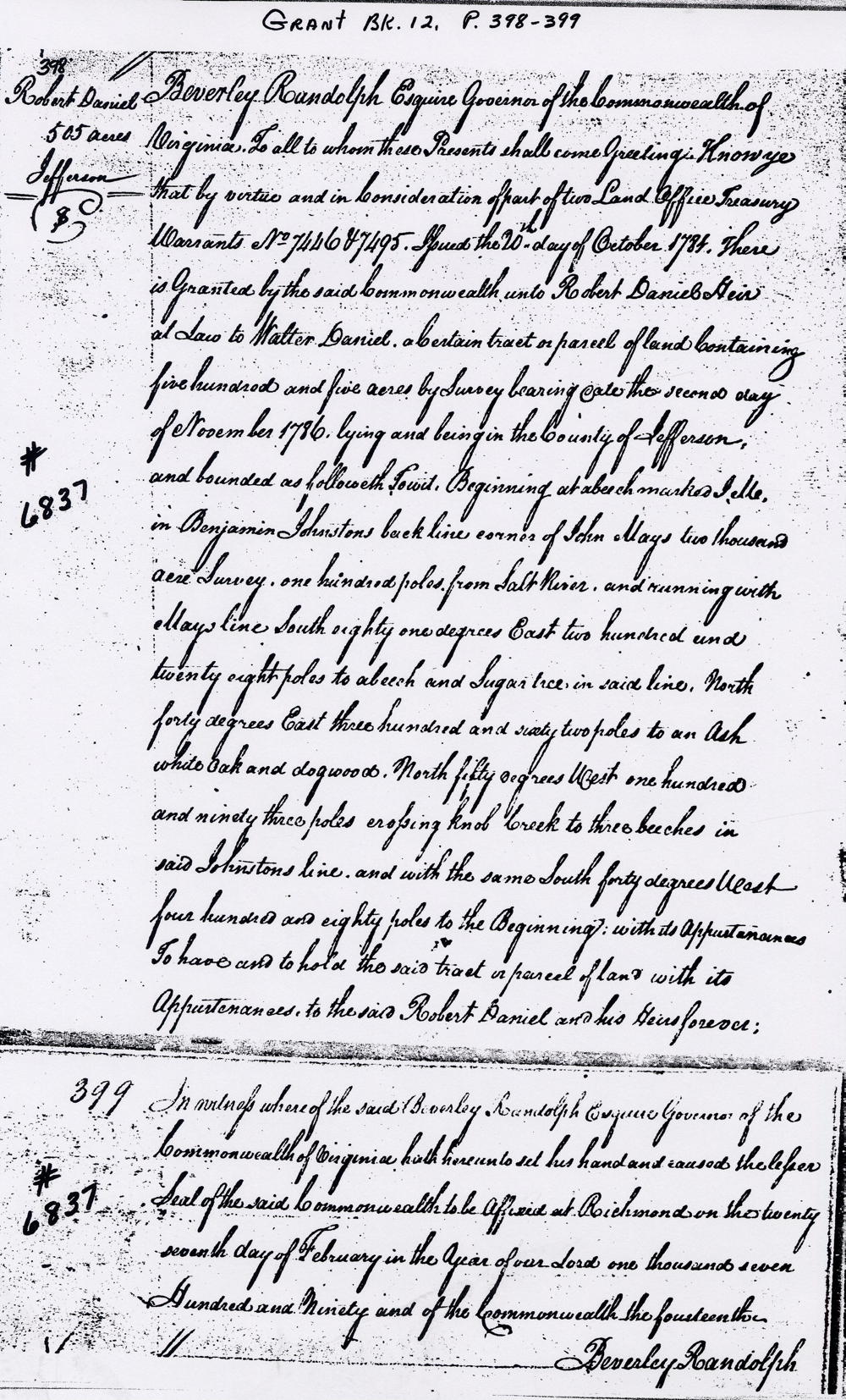
Virginia Grant Book 12, pages 398-9
Beverly Randolph Esquire, Governor of the Commonwealth of Virginia, to all to whom these presents shall come, greeting. Know ye that by virtue and in consideration of part of two land office treasury warrants No. 7446 & 7495, issued the 20th day of October 1784, there is granted by the said Commonwealth unto Robert Daniel, heir at law to Walker Daniel, a certain tract or parcel of land containing 505 acres by survey bearing date the second day of November 1786, lying and being in the county of Jefferson and bounded as followeth, to wit. Beginning at a beech marked I.M. in Benjamin Johnston's back line, corner of John May's 2000 acre survey, 100 poles from Salt River, and running with May's line South 81° East 228 poles to a beech & sugar tree in said line, North 40° East 362 poles to an ash, white oak and dogwood, North 50° West 193 poles crossing Knob Creek to three beeches in said Johnston's line, and with the same South 40° West 480 poles to the beginning with its appurtenances to have and to hold the said tract or parcel of land with its appurtenances to the said Robert Daniel and his heirs forever. In witness whereof the said Beverly Randolph Esquire, Governor of the Commonwealth of Virginia hath hereunto set his hand and caused the lesser seal of the said Commonwealth to be affixed at Richmond on the 27th day of February in the year of our Lord 1790, and of the Commonwealth the 14th. (signed) Beverly Randolph
Warrant
If you, the reader, have an interest in any particular part of our county history, and wish to contribute to this effort, use the form on our Contact Us page to send us your comments about this, or any Bullitt County History page. We welcome your comments and suggestions. If you feel that we have misspoken at any point, please feel free to point this out to us.
The Bullitt County History Museum, a service of the Bullitt County Genealogical Society, is located in the county courthouse at 300 South Buckman Street (Highway 61) in Shepherdsville, Kentucky. The museum, along with its research room, is open 10 a.m. to 4 p.m. Monday through Friday. Saturday appointments are available by calling 502-921-0161 during our regular weekday hours. Admission is free. The museum, as part of the Bullitt County Genealogical Society, is a 501(c)3 tax exempt organization and is classified as a 509(a)2 public charity. Contributions and bequests are deductible under section 2055, 2106, or 2522 of the Internal Revenue Code. Page last modified: 21 Apr 2026 . Page URL: bullittcountyhistory.org/bchistory/6837-daniel.html