
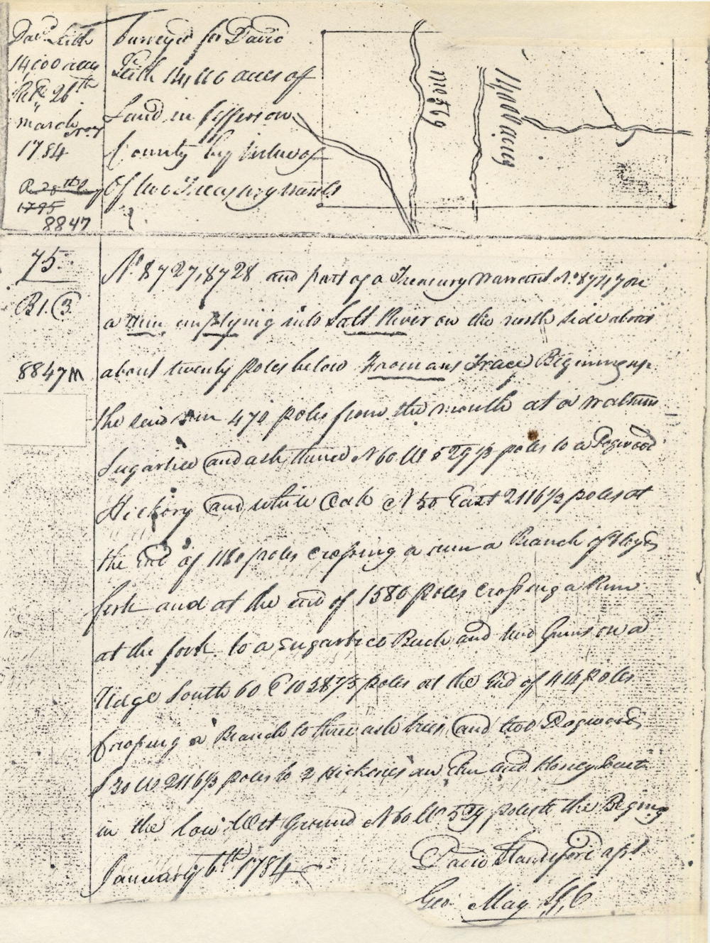
On 6 Jan 1784, David Standiford surveyed this 14,000 acre tract for David Leitch. A deed for the tract would not be issued until 11 Jan 1795. David Leitch possessed large tracts of land in several parts of Kentucky, including these 14,000 acres in present-day northeastern Bullitt County, when he died in 1794. He willed his entire estate to his wife Keturah (Moss) Leitch, as they had no children. A year after Leitch died, Keturah married the executor of her husband's will, General James Taylor, who was the founder of the city of Newport. Together James and Keturah would sell off parts of this tract during the following years.
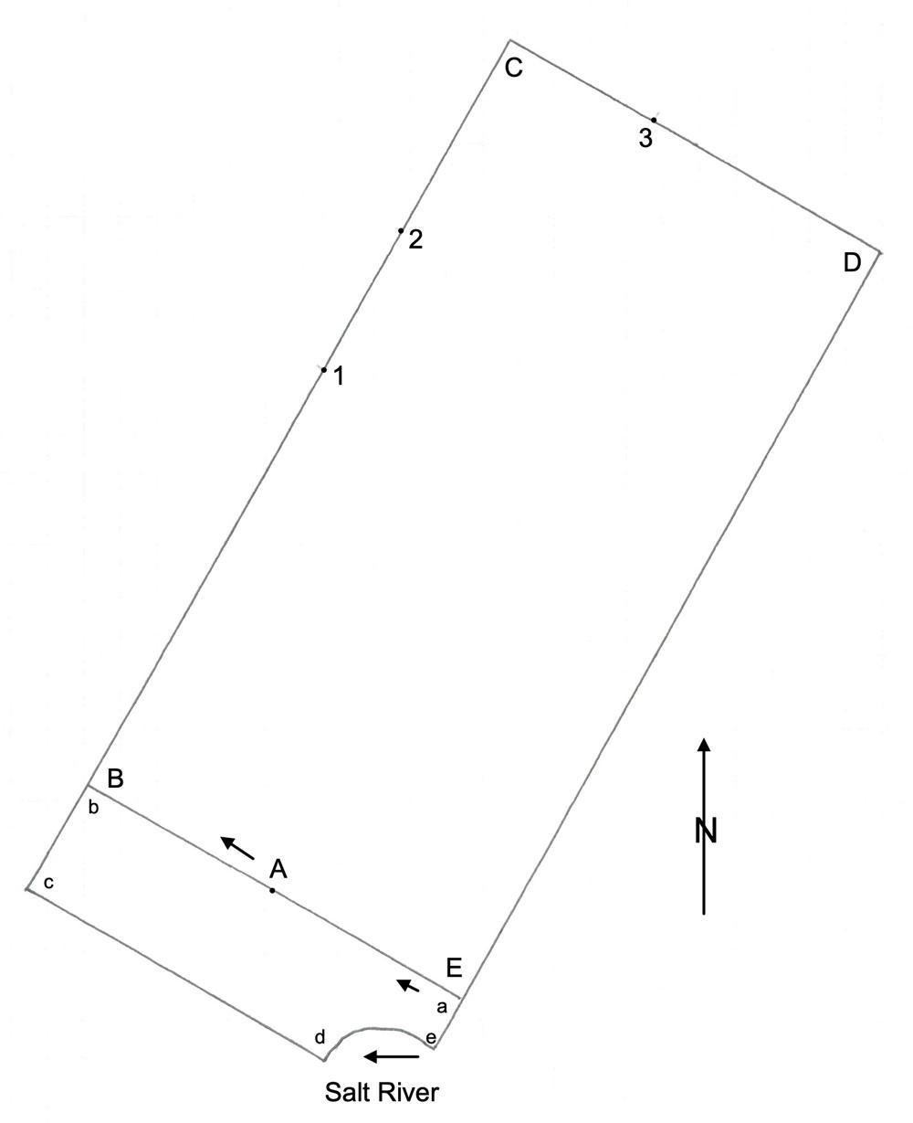
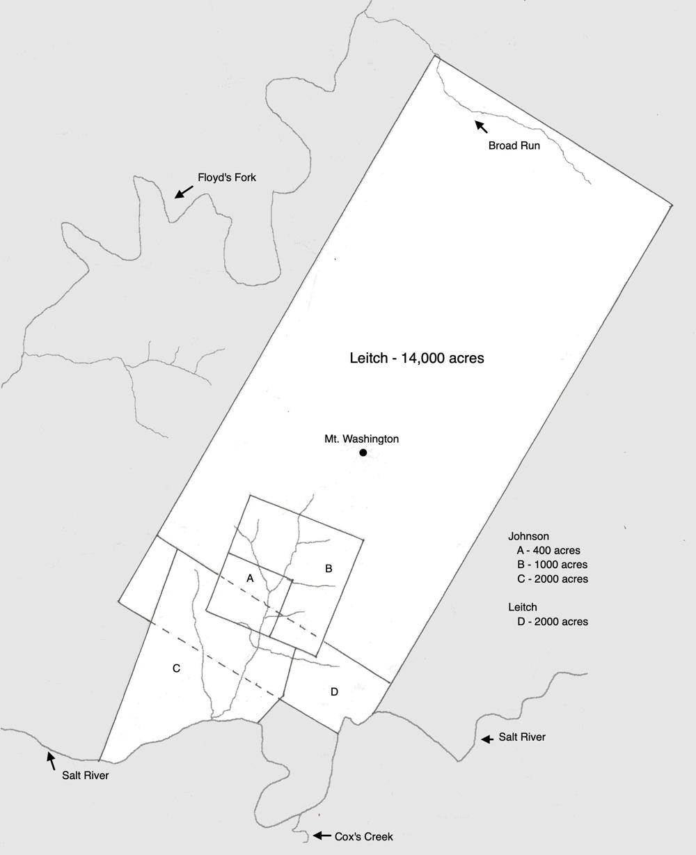
The drawing shown here plots the boundaries of this 14,000 acre tract, as well as an adjoining 2,000 acre tract that was surveyed later. The letters and numbers shown in red in the survey description below refer to those on this drawing.
Survey
Surveyed for David Leitch 14,000 acres of land in Jefferson County by virtue of two treasury warrants No. 8727, 8728 and part of a treasury warrant No. 8711 on a run emptying into Salt River on the north side about twenty poles below Froman's Trace. Beginning up said run 470 poles from the mouth, at [A] a walnut, sugar tree and ash, thence North 60° West 529 and 1/3 poles to [B] a dogwood, hackberry and white oak, North 30° East 2116 1/3 poles at the end of 1180 poles crossing [1] a run a branch of Floyd's Fork and at the end of 1580 poles crossing [2] a run at the fork to [C] a sugar tree, beech & two gums on a ridge, South 60° East 1058 1/3 poles at the end of 404 poles crossing [3] a branch to [D] three ash trees and two dogwoods, South 30° West 2116 1/3 poles to [E] two hickorys, an elm and honey locust in the lowest ground, North 60° West 529 poles to the beginning January 6th 1784. David Standiford, surveyor.
Deed
Kentucky Grant Book 16, pages 12-13
Isaac Shelby Esquire, governor of the Commonwealth of Kentucky, to all to whom these presents shall come, greeting. Know ye that by virtue and in consideration of two land office treasury warrants numbers 8727 & 8728 & part of 8711 there is granted by the said commonwealth unto David Leitch a certain tract or parcel of land containing fourteen thousand acres by survey bearing date the sixth day of January 1784, lying and being in Jefferson County on a run emptying into Salt River on the north side about 20 poles below Froman's Trace and bounded as followeth to wit. Beginning up said run 470 poles from the mouth, a walnut, sugar tree and ash, thence North 60° West 529 and 1/3 poles to a dogwood, hackberry and white oak, North 30° East 2116 1/3 poles at the end of 1180 poles crossing a run a branch of Floyd's Fork and at the end of 1580 poles crossing a run at the fork to a sugar tree, beech & two gums on a ridge, South 60° East 1058 1/3 poles at the end of 404 poles crossing a branch to three ash trees and two dogwoods, South 30° West 2116 1/3 poles to two hickorys, an elm and honey locust in the lowest ground, North 60° West 529 poles to the beginning with its appurtenances to have and to hold the said tract or parcel of land with its appurtenances to the said David Leitch & his heirs forever. In witness whereof the said Isaac Shelby Esquire, Governor of the Commonwealth of Kentucky, hath hereunto set his hand and caused the seal of the Commonwealth to be affixed at Frankfort on the 11th day of January in the year of our Lord 1795, & of the Commonwealth the third. (signed) Isaac Shelby
The drawing below shows our best estimate of the location of Leitch's 2 tracts with the locations of Mt. Washington, and of Richard Johnson's claims along McCollough Run.
If you, the reader, have an interest in any particular part of our county history, and wish to contribute to this effort, use the form on our Contact Us page to send us your comments about this, or any Bullitt County History page. We welcome your comments and suggestions. If you feel that we have misspoken at any point, please feel free to point this out to us.
The Bullitt County History Museum, a service of the Bullitt County Genealogical Society, is located in the county courthouse at 300 South Buckman Street (Highway 61) in Shepherdsville, Kentucky. The museum, along with its research room, is open 10 a.m. to 4 p.m. Monday through Friday. Saturday appointments are available by calling 502-921-0161 during our regular weekday hours. Admission is free. The museum, as part of the Bullitt County Genealogical Society, is a 501(c)3 tax exempt organization and is classified as a 509(a)2 public charity. Contributions and bequests are deductible under section 2055, 2106, or 2522 of the Internal Revenue Code. Page last modified: 21 Apr 2026 . Page URL: bullittcountyhistory.org/bchistory/8847-leitch.html