
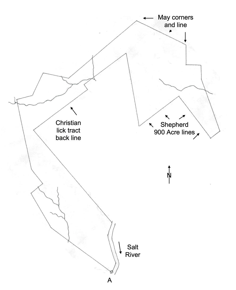
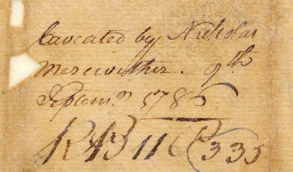
On 6 Jan 1786, Robert Breckinridge surveyed 2000 acres for Colonel William Christian that adjoined his Bullitt Lick tract, and also the 900 acre tract of Peter Shepherd. However, Nicholas Meriwether filed a caveat against Christian's claim on 9 Sep 1786, and it appears that Christian did not receive a deed for it. A drawing of the tract is shown here.
Survey
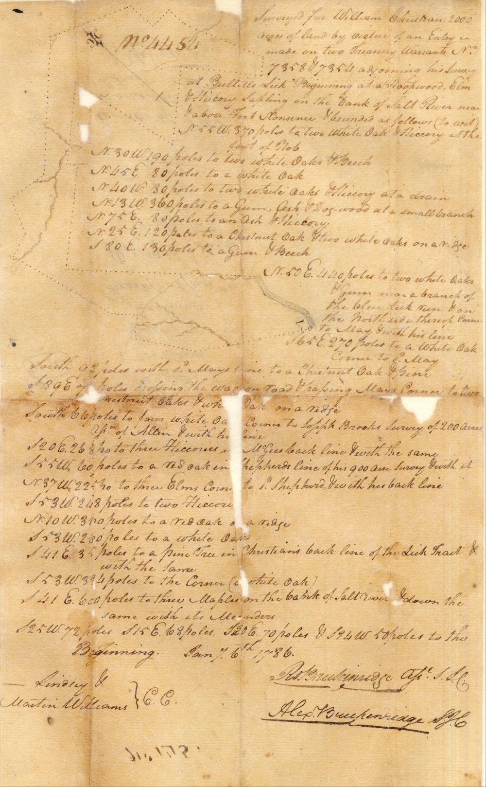
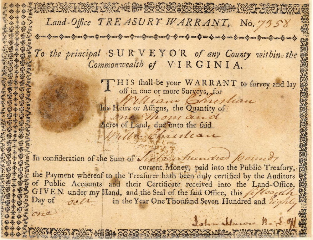
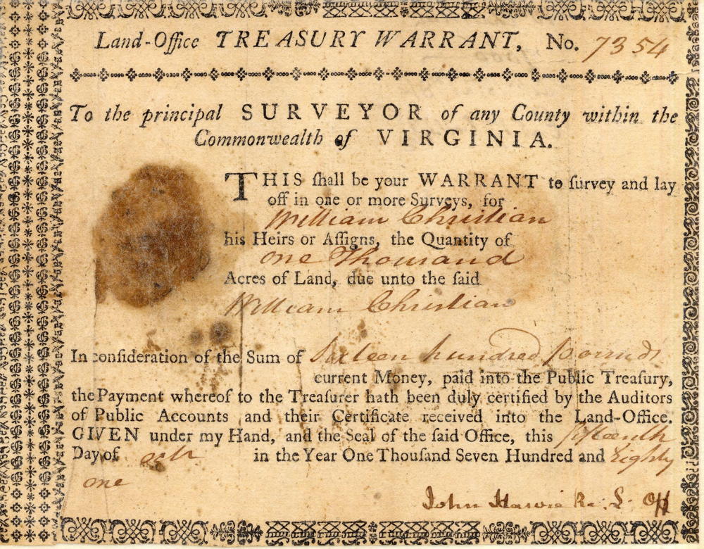
Surveyed for William Christian 2000 acres of land by virtue of an entry made on two treasury warrants No. 7358 & 7354 adjoining his survey at Bullitt's Lick. Beginning at a hoopwood, elm & hickory sapling on the bank of Salt River near & above Fort Nonsense & bounded as follows (to wit), N 55° W 370 poles to two white oak & hickory at the foot of knob, N 30° W 190 poles to two white oaks & beech, N 45° E 90 poles to a white oak, N 40° W 80 poles to two white oaks & hickory at a drain, N 13° W 360 poles to a gum, ash & dogwood at a small branch, N 75° E 80 poles to an ash & hickory, N 25° E 120 poles to a chestnut oak & two white oaks on a ridge, S 80° E 130 poles to a gum & beech, N 50° E 440 poles to two white oaks & gum near a branch of the blue lick run & on the north side thereof, corner to May & with his line, S 65° E 270 poles to a white oak, corner to said May, South 92 poles with said May's line to a chestnut oak & pine, S 89° E 79 poles crossing the wagon road & crossing May's corner to two chestnut oaks & white oak on a ridge, South 66 poles to four white oaks, corner to Joseph Brooks' survey of 200 acres, assignee of Allen & with his line, S 20° E 268 poles to three hickories in McGee's back line & with the same, S 55° W 60 poles to a red oak in Shepherd's line of his 900 acre survey & with it, N 37° W 225 poles to three elms, corner to said Shepherd & with his back line, S 53° W 248 poles to two hickories, N 10° W 300 poles to a red oak on a ridge, S 53° W 280 poles to a white oak, S 41° E 35 poles to a pine tree in Christian's back line of the lick tract & with the same, S 53° W 334 poles to the corner (a white oak), S 41° E 600 poles to three maples on the bank of Salt River & down the same with its meanders, S 25° W 72 poles, S 15° E 68 poles, S 20° E 70 poles &, S 24° W 50 poles to the beginning. January 6th, 1786. Robert Breckinridge, surveyor. Lindsay & Martin Williams, chain carriers.
Warrant
If you, the reader, have an interest in any particular part of our county history, and wish to contribute to this effort, use the form on our Contact Us page to send us your comments about this, or any Bullitt County History page. We welcome your comments and suggestions. If you feel that we have misspoken at any point, please feel free to point this out to us.
The Bullitt County History Museum, a service of the Bullitt County Genealogical Society, is located in the county courthouse at 300 South Buckman Street (Highway 61) in Shepherdsville, Kentucky. The museum, along with its research room, is open 10 a.m. to 4 p.m. Monday through Friday. Saturday appointments are available by calling 502-921-0161 during our regular weekday hours. Admission is free. The museum, as part of the Bullitt County Genealogical Society, is a 501(c)3 tax exempt organization and is classified as a 509(a)2 public charity. Contributions and bequests are deductible under section 2055, 2106, or 2522 of the Internal Revenue Code. Page last modified: 21 Apr 2026 . Page URL: bullittcountyhistory.org/bchistory/9196-christian.html