
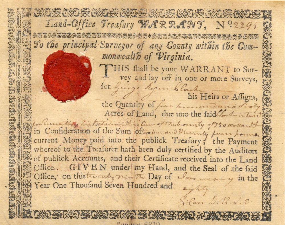
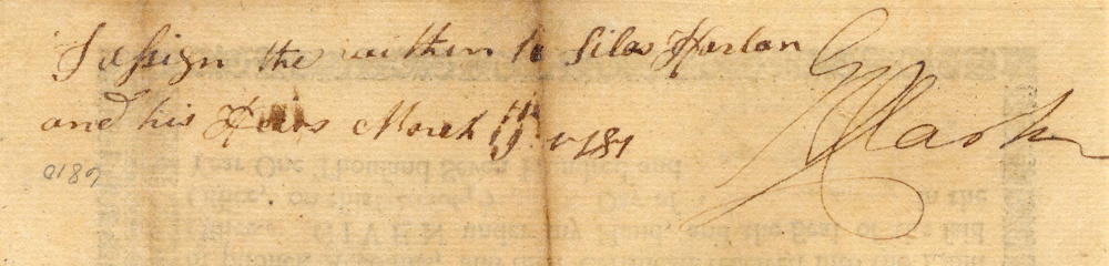
On 29 Jan 1780, George Rogers Clark received the land warrant you see below. Then in March 1781, he signed it over to Silas Harlan, as noted on the back. Silas Harlan and his brother James accompanied James Harrod in founding Harrodstown in 1774. Later he served with Clark in the Illinois campaign, and then assisted in establishing Fort Jefferson at the mouth of the Ohio River. Major Silas Harlan was killed on 19 Aug 1782 while leading an advance party at the Battle of Blue Licks. Harlan County, Kentucky was later named for him.
Warrant
Previously, on 7 Jan 1780, Silas Harlan had written his last will and testament, distributing his estate to his brothers, John, Elijah, and James Harlan. A copy of this will is shown below.
Silas Harlan's Will
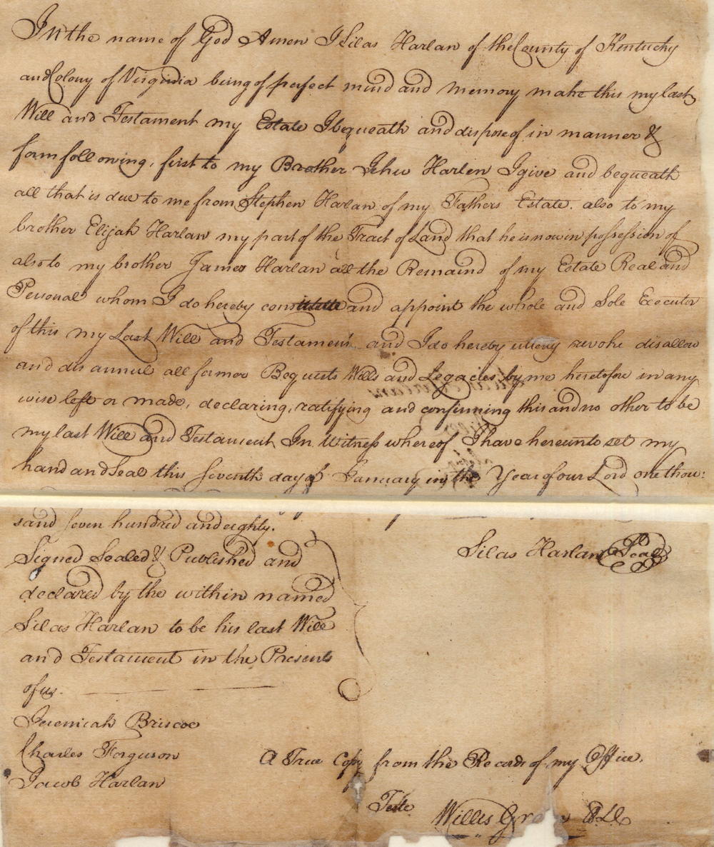
In the name of God Amen. I Silas Harlan of the County of Kentucky and Colony of Virginia, being of perfect mind and memory, make this my last will and testament my estate I bequeath and dispose of in manner of form following. First to my brother John Harlen I give and bequeath all that is due to me from Stephen Harlan of my father's estate, also to my brother Elijah Harlan my part of the tract of land that he is now in possession of, also to my brother James Harlan all the remains of my estate real and personal whom I do hereby constitute and appoint the whole and sole executer of this my last will and testament, and I do hereby utterly revoke, disallow and dis annul all former bequests, wills, legacies by me heretofore in any wise left or made, declaring, ratifying and confirming this and no other to be my last will and testament. In witness whereof I have hereunto set my hand and seal the seventh day of January in the year of our Lord one thousand seven hundred and eighty. (signed) Silas Harlan
Signed, sealed and published and declared by the within named Silas Harlan to be his last will and testament in the presents of us. (signed) Jeremiah Briscoe, Charles Ferguson, Jacob Harlan.
Nearly a decade passed before, on 15 May 1789, James Cox surveyed a tract of land in the name of Silas Harlan. This tract lay on the south side of Salt River between Cox's Creek and the Salt River Garrison (another name for Brashear's Station), as shown below.
Survey
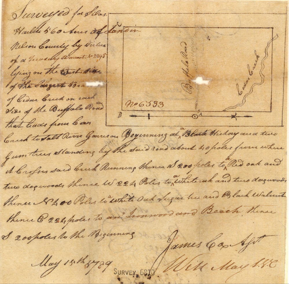
Surveyed for Silas Harlin 560 acres of land in Nelson County by virtue of a treasury warrant No. 2295 lying on the west side of the largest branch of Cedar Creek on each side of the buffalo road that leads from Coxes Creek to Salt River Garrison, beginning at a black hickory and two gum trees standing by the said road about 40 poles from where it crosses said creek, running thence S 200 poles to a red oak and two dogwoods, thence W 224 poles to a white oad and two dogwoods, thence N 400 poles to a white oak, sugar tree and black walnut, thence E 222 poles to an ironwood and beech, thence S 200 poles to the beginning. May 15th 1789. James Cox, Assistant Surveyor
The following year, on 21 May 1790, Silas' brother James received a deed to the tract, as shown below.
Deed
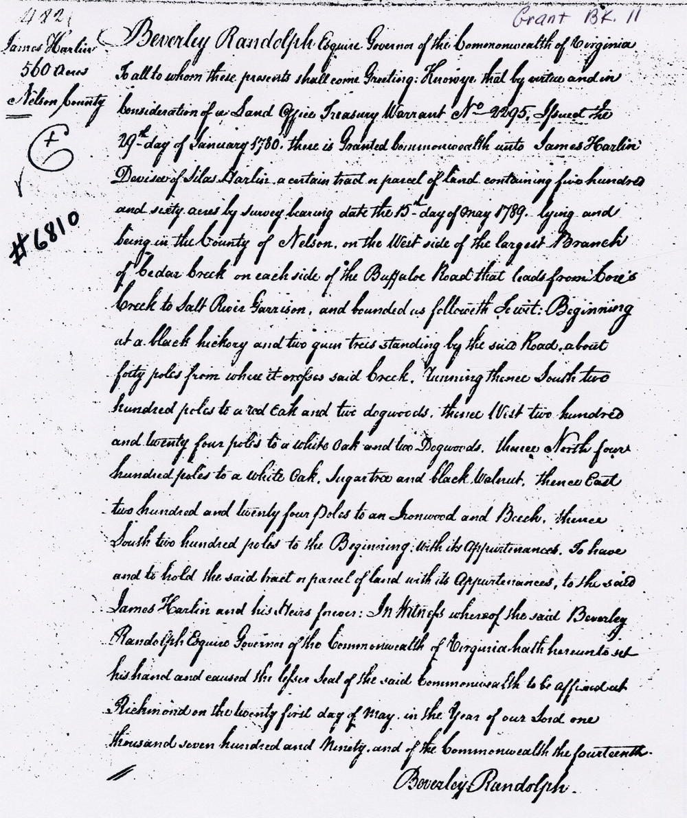
Virginia Grant Book 11, page 482
Beverly Randolph Esquire, Governor of the Commonwealth of Virginia, to all to whom these presents shall come, greeting. Know ye that by virtue and in consideration of a land office treasury warrant No. 2295 issued the 29th day of January 1780 there is granted [by the] Commonwealth unto James Harlin, devisee of Silas Harlin a certain tract or parcel of land containing five hundred and sixty acres by survey bearing date the 15th day of May 1789, lying and being in the County of Nelson on the west side of the largest branch of Cedar Creek on each side of the buffalo road that leads from Coxes Creek to Salt River Garrison and bounded as followeth, to wit. Beginning at a black hickory and two gum trees standing by the said road about forty poles from where it crosses said creek, running thence South two hundred poles t oa red oak and two dogwoods, thence West two hundred and twenty four poles to a white oak and two dogwoods, thence North four hundred poles to a white oak, sugar tree and black walnut, thence East two hundred and twenty four poles to an ironwood and beech, thence South two hundred poles to the beginning with its appurtenances to have and to hold the said tract or parcel of land with its appurtenances to the said James Harlin and his heirs forever. In witness whereof the said Beverly Randolph Esquire, Governor of the Commonwealth of Virginia, hath hereunto set his hand and caused the lesser seal of the said Commonwealth to be affixed at Richmond on the twenty first day of May in the year of our Lord one thousand seven hundred and ninety, and of the Commonwealth the fourteenth. (signed) Beverly Randolph
If you, the reader, have an interest in any particular part of our county history, and wish to contribute to this effort, use the form on our Contact Us page to send us your comments about this, or any Bullitt County History page. We welcome your comments and suggestions. If you feel that we have misspoken at any point, please feel free to point this out to us.
The Bullitt County History Museum, a service of the Bullitt County Genealogical Society, is located in the county courthouse at 300 South Buckman Street (Highway 61) in Shepherdsville, Kentucky. The museum, along with its research room, is open 10 a.m. to 4 p.m. Monday through Friday. Saturday appointments are available by calling 502-921-0161 during our regular weekday hours. Admission is free. The museum, as part of the Bullitt County Genealogical Society, is a 501(c)3 tax exempt organization and is classified as a 509(a)2 public charity. Contributions and bequests are deductible under section 2055, 2106, or 2522 of the Internal Revenue Code. Page last modified: 12 Sep 2024 . Page URL: bullittcountyhistory.org/bchistory/james-harlan560.html