
Thomas Carlane received a certificate for settlement and preemption by residing in the western country for 12 months before 1778. Isaac Cox surveyed the settlement land for him on 1 Jan 1783, but it appears that he had signed the certificate over to David Gist who then signed everything over to Jeremiah Tilford.
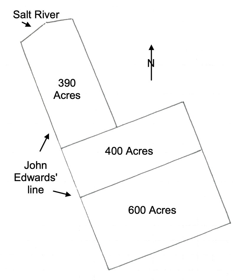
This drawing shows the relationship of the three Tilford tracts which lay south of Salt River and along Cedar Creek. All related documents and their transcriptions are given below.
There was a dispute with John Gaither over a land boundary which was settled in court in 1803, which may involve these deeds.
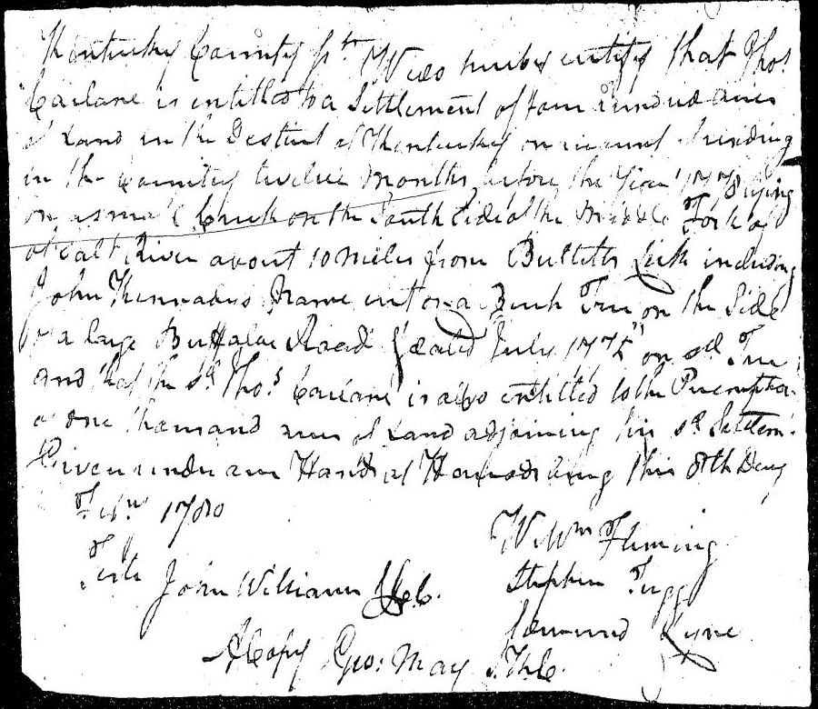
Certificate
Kentucky County Sct
We do hereby certify that Thos Carlane is entitled to a settlement of four hundred acres of land in the District of Kentucky on account of residing in the country twelve months before the year 1778 lying on a small creek on the south side of the middle fork of Salt River about 10 miles from Bullitt's Lick including John Kennedy's name into a beech tree od the side of a large buffalo road & dated July 1775 on all of and that the said Thos Carlane is aldo entitled to the preemption of one thousand acres of land adjoining his said settlement. Given under our hand at Harrodsburg this 8th day of February 1780. (signed) Wm Fleming, Stephen Trigg, Edmund Lyne.
A copy: Geo May, S.J.C.
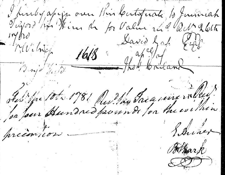
I hereby assign over this certificate to Jeremiah Telford for him in for value rec'd. Ict 26th 1780. (signed) David Gist, assignee of Thos Carlane.
Feb the 10th 1781. Rec'd the treasury warrant for four hundred pounds for the within preemption. (signed) ??
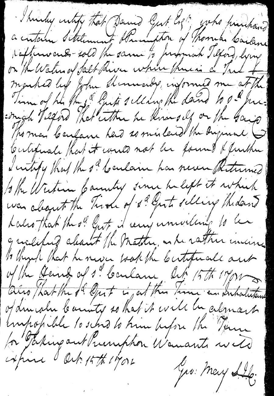
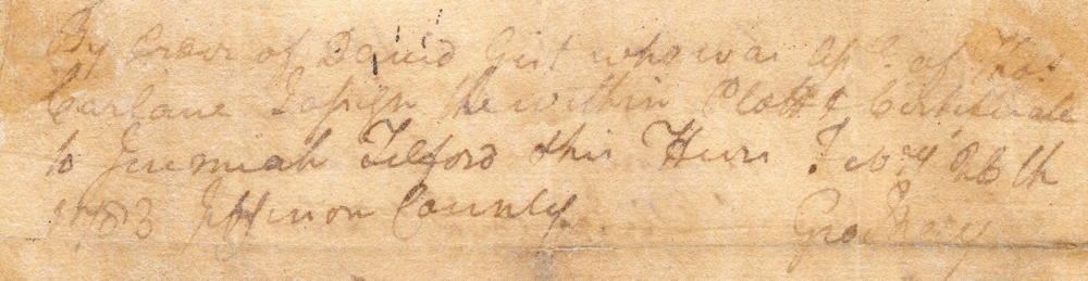
I hereby certify that David Gist Esquire who purchased a certain settlement & preemption of Thomas Carlane afterward sold the same to Jeremiah Telford, lying on the waters of Salt River where there is a tree marked by John Kennedy, informed me at the time of his the said Gist selling the land to Jeremiah Telford that either he himself or the said Thomas Carlane had so mislaid(?) the original certificate that it could not be found & further I certify that the said Carlane has never returned to the Western Country since he left it which was about the time of said Gist selling the land & also that the said Gist is very willing to be qualified about the matter as he rather inclined to think that he never took the certificate out of the hand of said Carlane. Oct 15th 1781. Also that the said Gist is at this time an inhabitant of Lincoln County so that it will be almost impossible to send to him before the term for taking out preemption warrants will expire. Oct 15th 1781. (signed) George May, S.J.C.
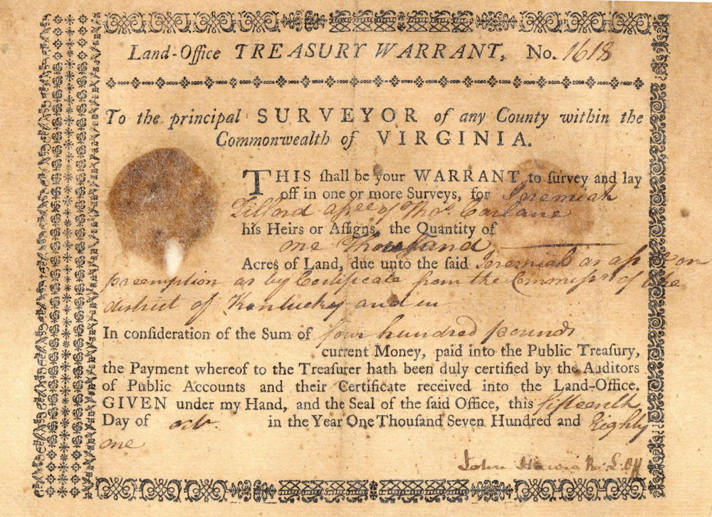
Warrant
Survey for 400 Acres
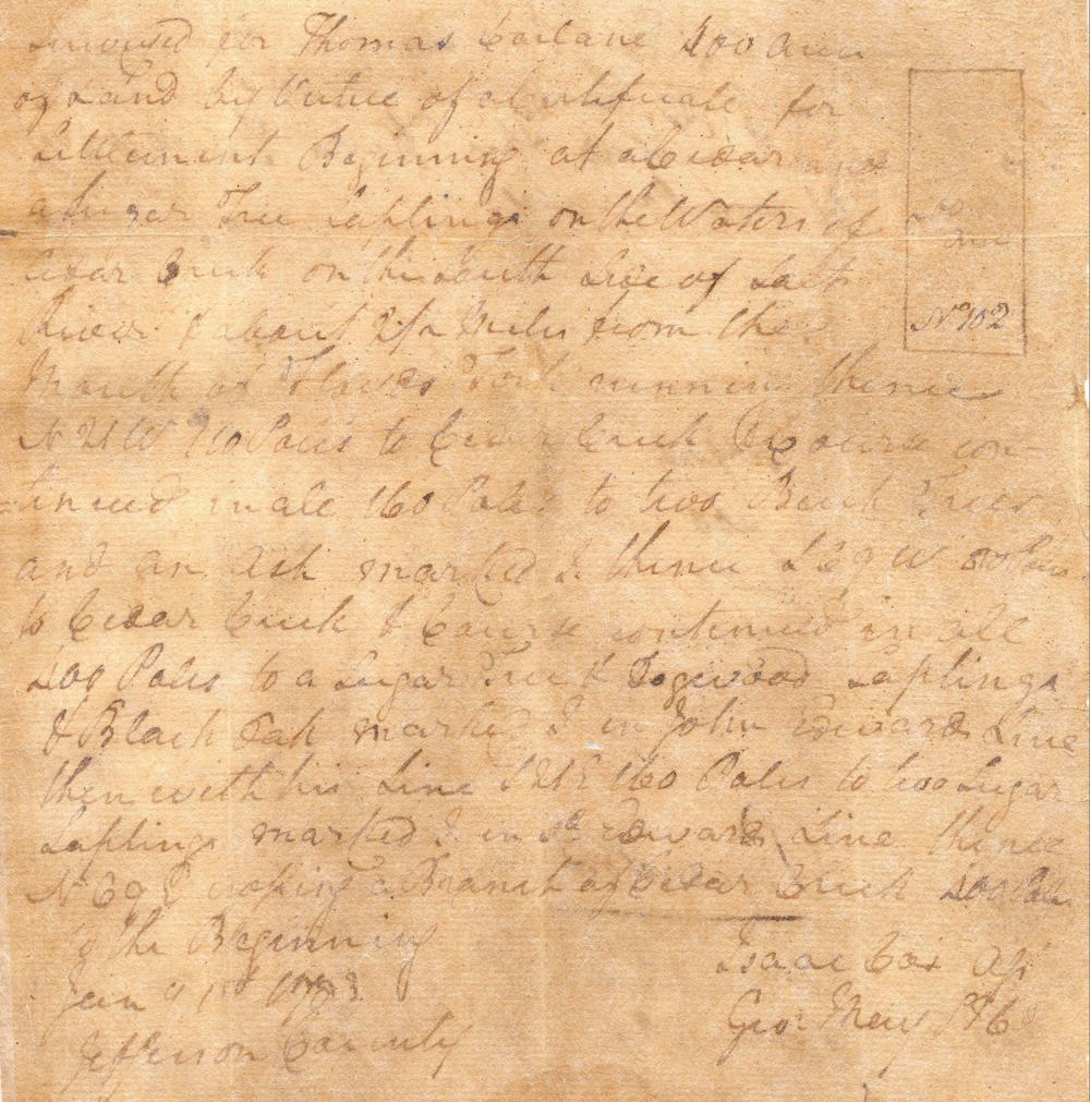
Surveyed for Thomas Carlane 400 acres of land by virtue of a certificate of settlement. Beginning at a cedar and sugar tree saplings on the waters of Cedar Creek on the south side of Salt River and about two and a half miles from the mouth of Floyd's Fork, running thence N 21° W 110 poles to Cedar Creek course continued in all 160 poles to two beech trees and an ash marked I, thence S 69° W 80 poles to Cedar Creek and course continued in all 400 poles to a sugar tree and dogwood saplings and black oak marked I in John Edward's line, thence with his line S 21° E 160 poles to two sugar saplings marked I in said Edward's line, thence N 69° E crossing a branch of Cedar Creek 400 poles to the beginning. Jan 1st 1783. Jefferson County. Isaac Cox, surveyor.
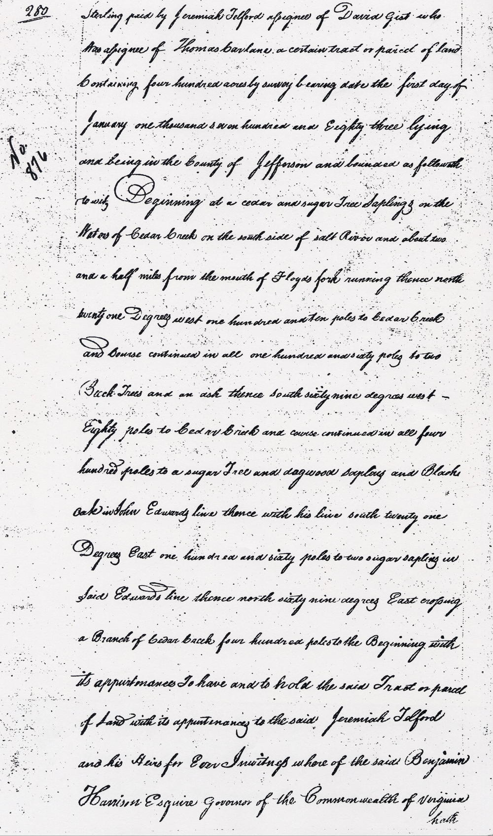
Deed for 400 acres
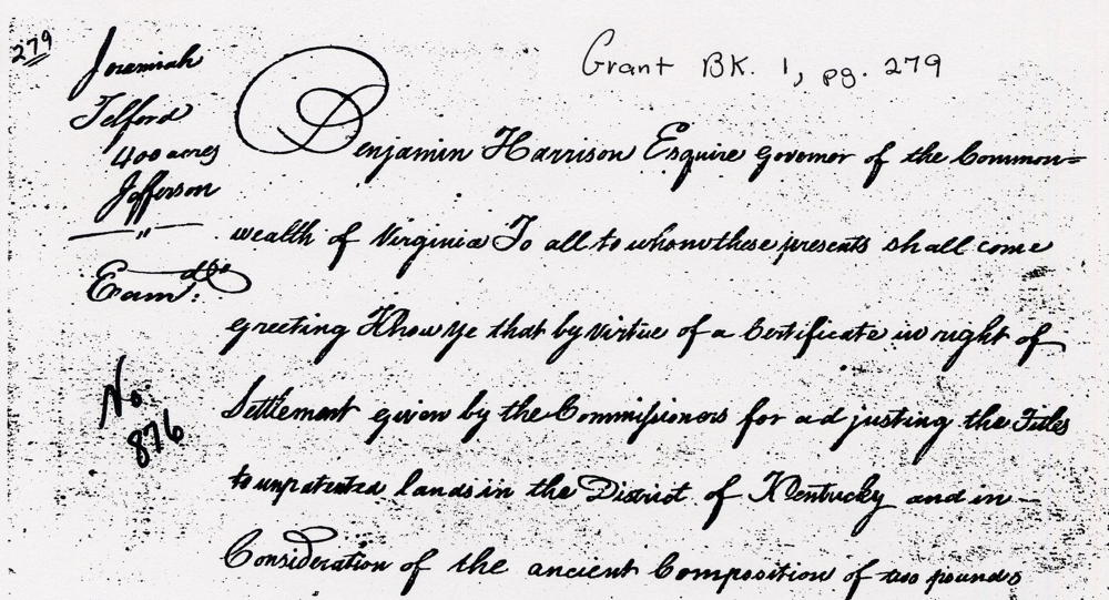
Virginia Grant Book 1, pages 279-281
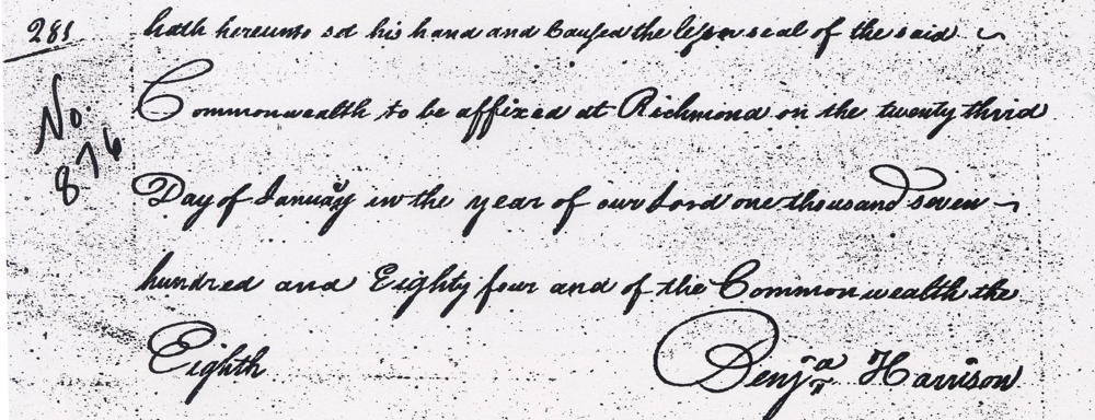
Benjamin Harrison Esquire, Governor of the Commonwealth of Virginia, to all to whom these presents shall come, greeting. Know ye that by virtue of a certificate in right of settlement given by the commissioners for adjusting the titles to unpatented lands in the District of Kentucky and in consideration of the ancient composition of pounds sterling paid by Jeremih Telford assignee of David Gist who was assignee of Thomas Carlane a certain tract or parcel of land containing 400 acres by survey bearing date the first day of January 1783 lying and being in the county of Jefferson and bounded as followeth, to wit. Beginning at a cedar and sugar tree saplings on the waters of Cedar Creek on the south side of Salt River and about two and a half miles from the mouth of Floyd's Fork, running thence North 21° West 110 poles to Cedar Creek and course continued in all 160 poles to two beech trees and an ash, thence South 69° West 80 poles to Cedar Creek and course continued in all 400 poles to a sugar tree and dogwood saplings and black oak in John Edward's line, thence with his line South 21° East 160 poles to two sugar saplings in said Edward's line, thence North 69° East crossing a branch of Cedar Creek 400 poles to the beginning with its appurtenances to have and to hold the said tract or parcel of land with its appurtenances to the said Jeremiah Telford and his heirs forever. In witness whereof the said Benjamin Harrison Esquire, Governor of the Commonwealth of Virginia hath hereunto set his and caused the lesser seal of the said Commonwealth to be affixed at Richmond on the 23rd day of January in the year of our Lord one thousand seven hundred and eighty four, and of the Commonwealth the eighth. (signed) Benjamin Harrison
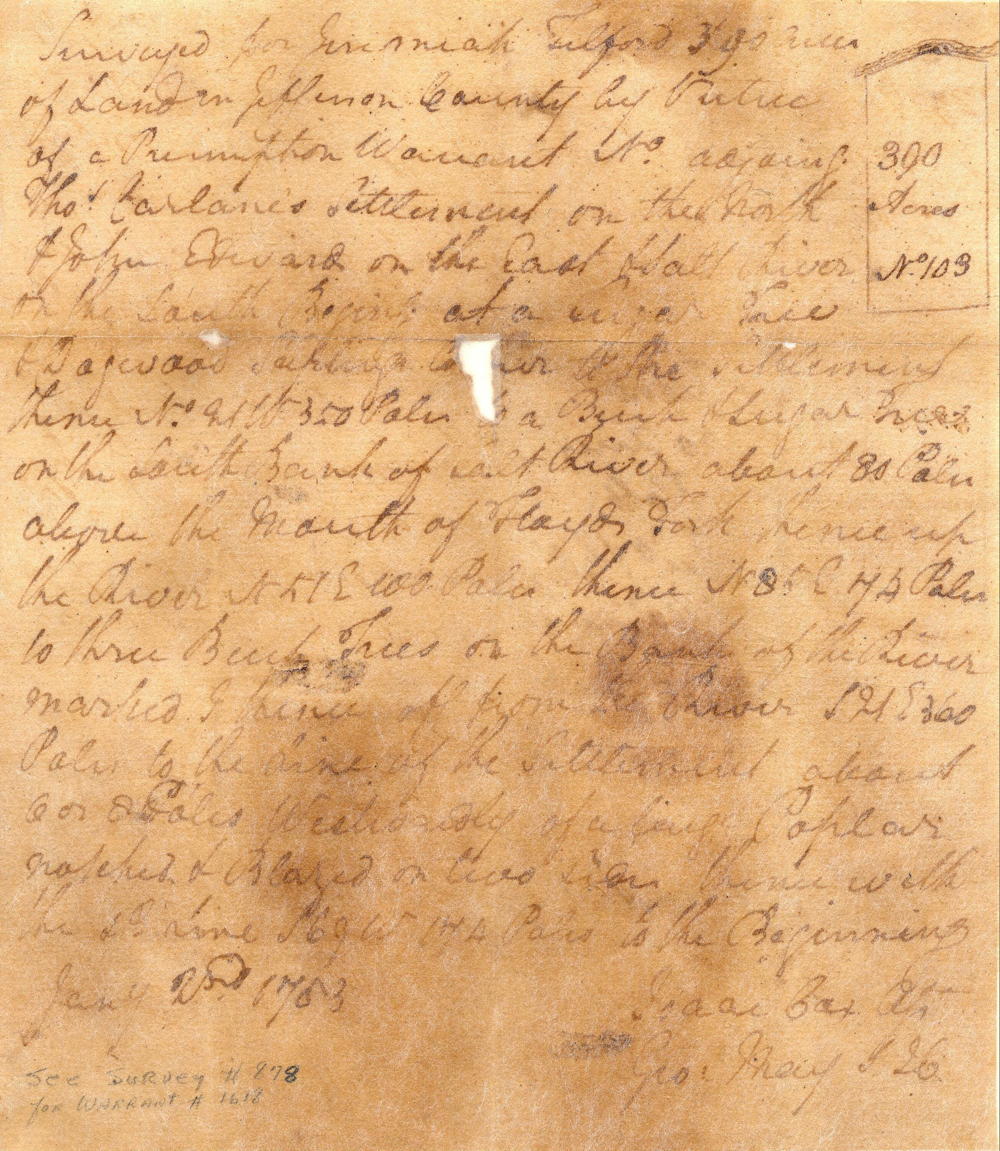
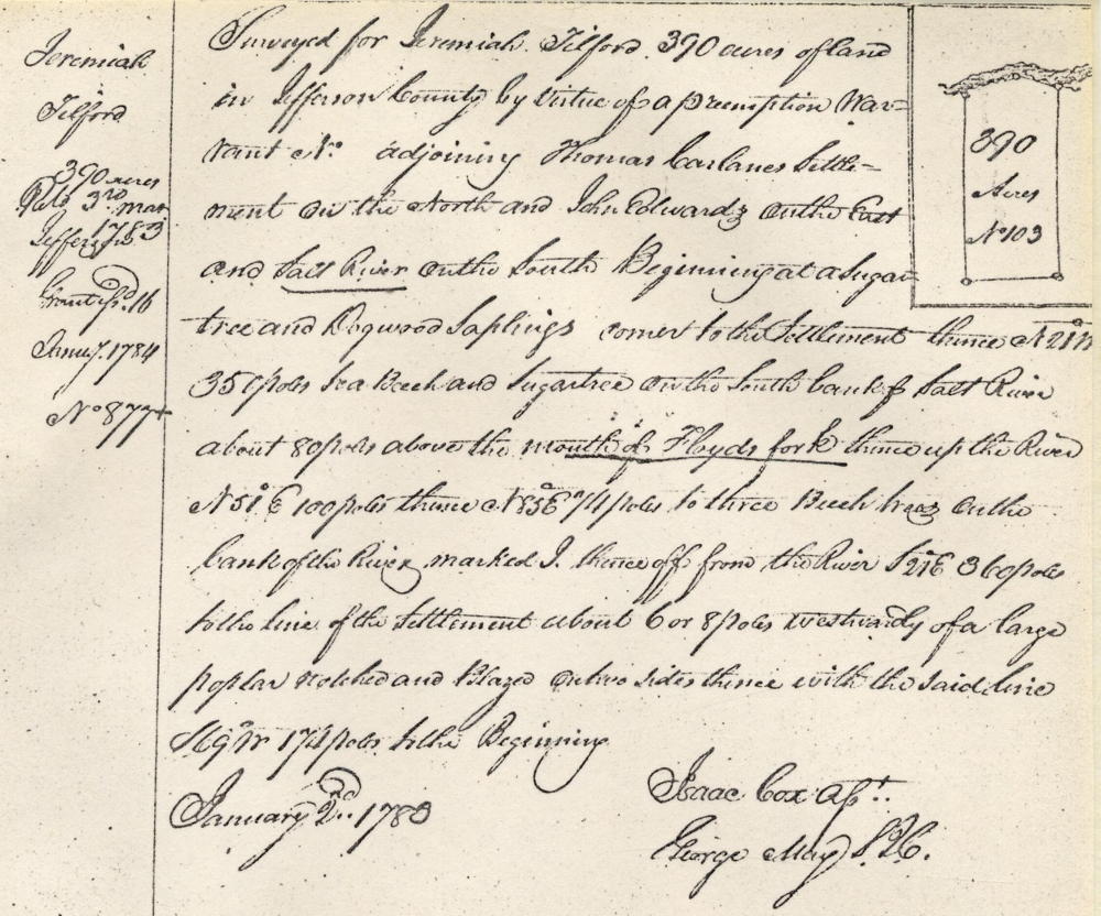
Survey for 390 Acres
Surveyed for Jeremiah Tilford 390 acres of land in Jefferson County by virtue of a preemption warrant No. __ adjoining Thomas Carlane's settlement on the north and John Edwards' on the east, and Salt River on the south. Beginning at a sugar tree and dogwood saplings corner to the settlement, thence N 21° W 350 poles to a beech and sugar tree on the south bank of Salt River about 80 poles above the mouth of Floyd's Fork, thence up the river N 51° E 100 poles, thence N 85° E 74 poles to three beech trees on the bank of the river marked I, thence off from the river S 21° E 360 poles to the line of the settlement about 6 or 8 poles westwardly of a large poplar notched and blazed on two sides, thence with the said line S 69° W 174 poles to the beginning. January 2nd 1783. Isaac Cox, surveyor.
Deed for 390 acres
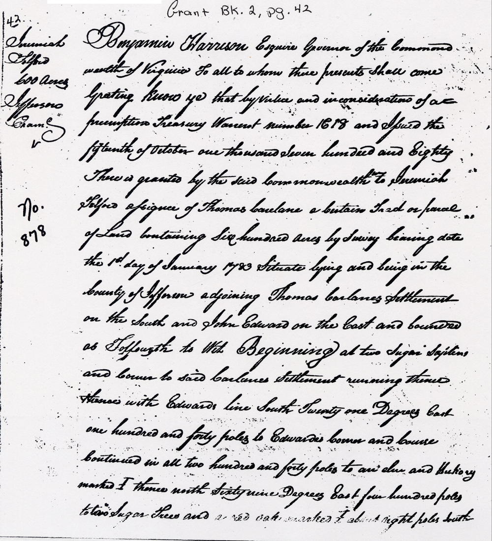
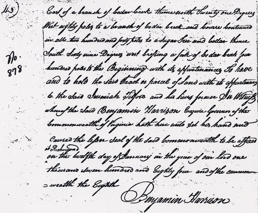
Virginia Grant Book 2, pages 42-43
Benjamin Harrison Esquire, Governor of the Commonwealth of Virginia, to all to whom these presents shall come, greeting. Know ye that by virtue and in consideration of a preemption treasury warrant number 1618 and issued the 15th day of October 1780, there is granted by the said Commonwealth unto Jeremiah Telford assignee of Thomas Carlane a certain tract or parcel of land containing 600 acres by survey bearing date the 1st day of January 1783, situate lying and being in the county of Jefferson adjoining Thomas Carlane's settlement on the south, and John Edward on the East, and bounded as followeth, to wit. Beginning at two sugar saplings and corner to said Carlane's settlement, running thence with Edward's line South 21° East 140 poles to Edward's corner and course continued in all 240 poles to an elm and hickory marked I, thence North 69° East 400 poles to two sugar trees and a red oak marked I about eight poles south east of a branch of Cedar Creek, thence North 21° West 80 poles to a branch of Cedar Creek and course continued in all 240 poles to a sugar tree and cedar, thence South 69° West crossing a fork of Cedar Creek 400 poles to the beginning with its appurtenances to have and to hold the said tract or parcel of land with its appurtenances to the said Jeremiah Telford and his heirs forever. In witness whereof the said Benjamin Harrison Esquire, Governor of the Commonwealth of Virginia hath hereunto set his and caused the lesser seal of the said Commonwealth to be affixed at Richmond on the 12th day of January in the year of our Lord one thousand seven hundred and eighty four, and of the Commonwealth the eighth. (signed) Benjamin Harrison
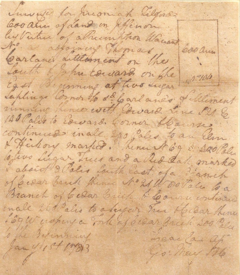
Survey for 600 Acres
Surveyed for Jeremiah Telford 600 acres of land in Jefferson County by virtue of a preemption warrant No. __ adjoining Thomas Carlane's settlement on the south & John Edwards' on the east. Beginning at two sugar saplings corner to said Carlane's settlement, running thence with Edward's line S 21° E 140 poles to Edward's corner and course continued in all 240 poles to an elm and hickory marked I, thence N 69° E 400 poles to two sugar trees and a red oak marked I about 8 poles south east of a branch of Cedar Creek, thence N 21° W 80 poles to a branch of Cedar Creek and course continued in all 240 poles to a sugar tree and cedar, thence S 69° W crossing a fork of Cedar Creek 400 poles to the beginning. January 1st 1783. Isaac Cox, surveyor
Deed for 600 acres
Virginia Grant Book 2, pages 54-55
Benjamin Harrison Esquire, Governor of the Commonwealth of Virginia, to all to whom these presents shall come, greeting. Know ye that by virtue and in consideration of a part of a preemption treasury warrant number 1618 and issued the 15th day of October 1781, there is granted by the said Commonwealth unto Jeremiah Telford assignee of Thomas Carlane a certain tract or parcel of land containing 390 acres by survey bearing date the 2nd day of January 1783 lying and being in the county of Jefferson adjoining Thomas Carlane's settlement on the north, John Edward - on the East, Salt River on the south and bounded as followeth, to wit. Beginning at a sugar tree and dogwood saplings corner to the settlement, thence North 21° West 350 poles to a beech and sugar tree on the south bank of Salt River about 80 poles above the mouth of Floyd's Fork, thence up the river North 51° East 100 poles, thence North 85° East 74 poles to three beech trees on the bank of the rivewr, thence off from the river South 21° East 360 poles to the line of the settlement about six or eight poles westwardly of a large poplar notched and blazed on two sides, thence with the said line South 69° West 174 poles to the beginning with its appurtenances to have and to hold the said tract or parcel of land with its appurtenances to the said Jeremiah Telford and his heirs forever. In witness whereof the said Benjamin Harrison Esquire, Governor of the Commonwealth of Virginia hath hereunto set his and caused the lesser seal of the said Commonwealth to be affixed at Richmond on the 16th day of January in the year of our Lord one thousand seven hundred and eighty four, and of the Commonwealth the eighth. (signed) Benjamin Harrison
If you, the reader, have an interest in any particular part of our county history, and wish to contribute to this effort, use the form on our Contact Us page to send us your comments about this, or any Bullitt County History page. We welcome your comments and suggestions. If you feel that we have misspoken at any point, please feel free to point this out to us.
The Bullitt County History Museum, a service of the Bullitt County Genealogical Society, is located in the county courthouse at 300 South Buckman Street (Highway 61) in Shepherdsville, Kentucky. The museum, along with its research room, is open 10 a.m. to 4 p.m. Monday through Friday. Saturday appointments are available by calling 502-921-0161 during our regular weekday hours. Admission is free. The museum, as part of the Bullitt County Genealogical Society, is a 501(c)3 tax exempt organization and is classified as a 509(a)2 public charity. Contributions and bequests are deductible under section 2055, 2106, or 2522 of the Internal Revenue Code. Page last modified: 12 Sep 2024 . Page URL: bullittcountyhistory.org/bchistory/jeremiah-tilford-tracts.html