
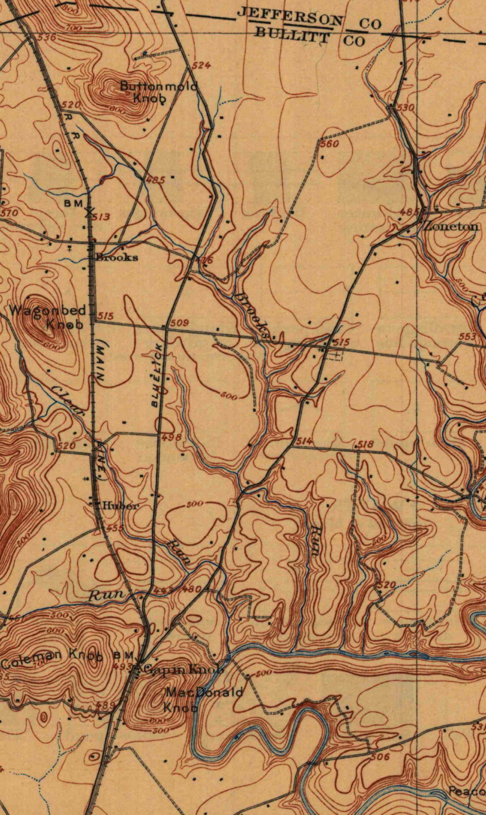
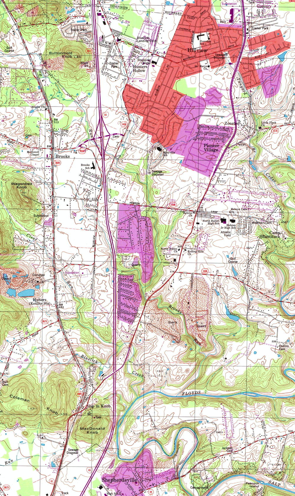
In 1907, the northern part of Bullitt County was fairly scarcely populated, and its roads were not in good condition. By 1997, 90 years later, its population had grown significantly, and its roadways were in much better condition. Now (in 2021) the roads are even better.
To appreciate the changes that took place over that 90 year span, we have displayed below two topographical maps, one from 1907 on the left, and one from 1997 on the right.
You may see an enlarged version of each map by following these links: 1907 | 1997. You may also compare them to a modern Google map on another page.
If you, the reader, have an interest in any particular part of our county history, and wish to contribute to this effort, use the form on our Contact Us page to send us your comments about this, or any Bullitt County History page. We welcome your comments and suggestions. If you feel that we have misspoken at any point, please feel free to point this out to us.
The Bullitt County History Museum, a service of the Bullitt County Genealogical Society, is located in the county courthouse at 300 South Buckman Street (Highway 61) in Shepherdsville, Kentucky. The museum, along with its research room, is open 10 a.m. to 4 p.m. Monday through Friday. Saturday appointments are available by calling 502-921-0161 during our regular weekday hours. Admission is free. The museum, as part of the Bullitt County Genealogical Society, is a 501(c)3 tax exempt organization and is classified as a 509(a)2 public charity. Contributions and bequests are deductible under section 2055, 2106, or 2522 of the Internal Revenue Code. Page last modified: 12 Sep 2024 . Page URL: bullittcountyhistory.org/bchistory/xxx.html