
This survey made 7 Aug 1792 for Robert Sanford by William Pope was for 2000 acres on the north side of Salt River just upstream from Pond Creek. We have rotated the drawing here to show it closer to its proper orientation.
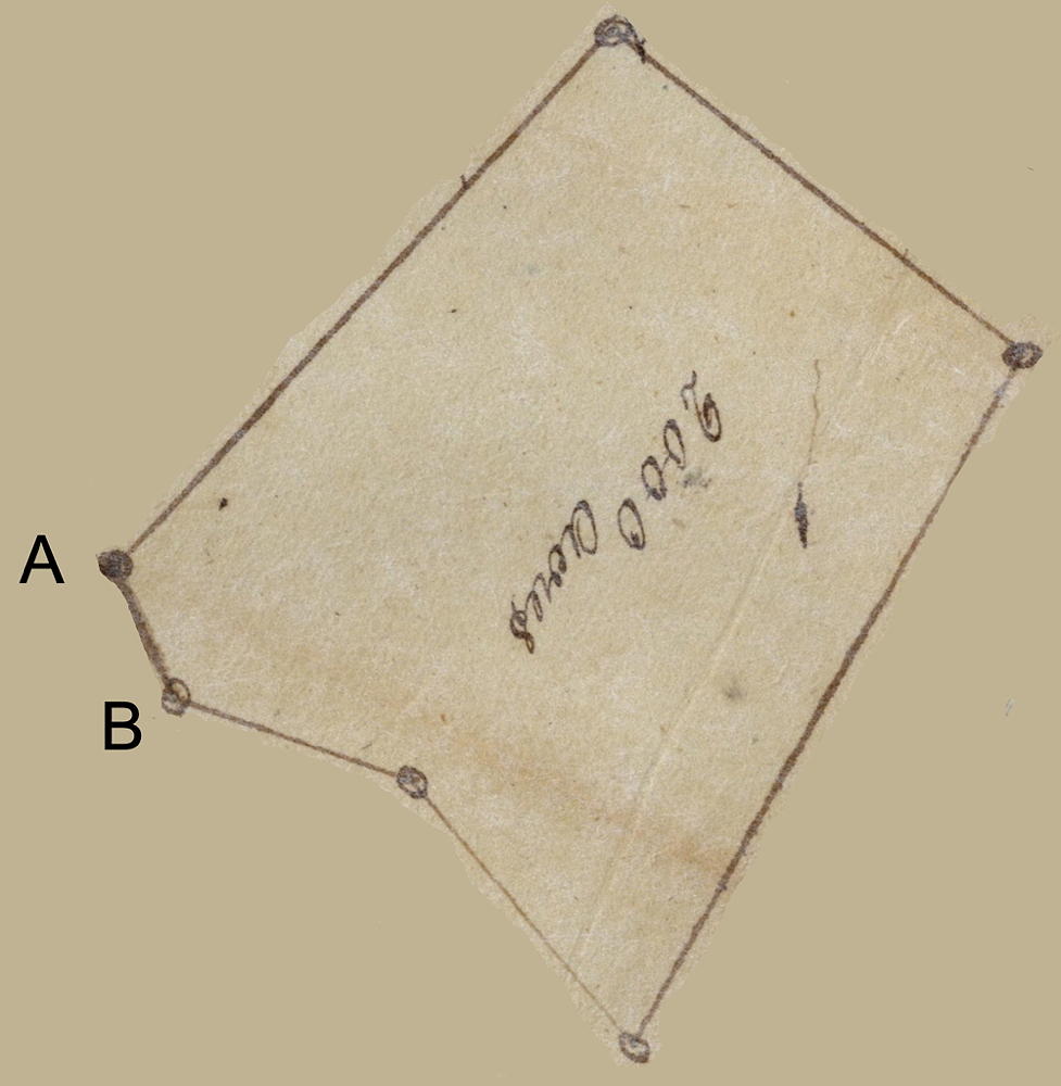
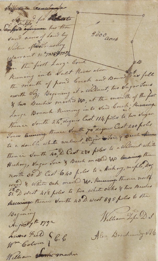
Survey
Surveyed for Robert Sanford 2000 acres of land by virtue of two treasury warrants No. 7538 and 7537 on the first large creek running into Salt River above the mouth of Pond Creek and bounded as followeth, viz.
Beginning at a walnut, two sugar trees and two beeches marked WP at the mouth of the first large branch running into said creek, thence South 24° East 114 poles to two sugar trees, thence South 70° East 200 poles to a double white walnut, sugar tree and beech, thence South 40° East 280 poles to a walnut, white hickory, sugar tree and beech marked WP, thence North 30° East 640 poles to a hickory, maple, dogwood and white oak marked WP, running thence North 52° West 418 poles to two white oaks and two beeches, thence South 43° West 595 poles to the beginning. William Pope, surveyor. August 7th 1792.
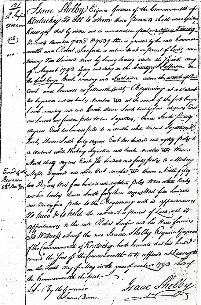
Deed
Isaac Shelby, Esquire, Governor of the Commonwealth of Kentucky to all to whom these presents shall come, greeting. Know ye that by virtue and in consideration of two land office treasury warrant, numbers 7538 and 7537, there is granted by the said Commonwealth unto Robert Sanford a certain tract or parcel of land containing 2000 acres by survey bearing date the seventh day of August 1792, lying and being in the county of Jefferson on the first large creek, running into Salt River above the mouth of Pond Creek, and bounded as followeth, to wit.
Beginning at a walnut, two sugar trees and two beeches marked WP at the mouth of the first large branch running into said creek, thence South 24° East 114 poles to two sugar trees, thence South 70° East 200 poles to a double white walnut, sugar tree and beech, thence South 40° East 280 poles to a walnut, white hickory, sugar tree and beech marked WP, thence North 30° East 640 poles to a hickory, maple, dogwood and white oak marked WP, thence North 52° West 418 poles to two white oaks and two beeches, thence South 43° West 595 poles to the beginning with its appurtenances.
To have and to hold the said tract or parcel of land with its appurtenances to the said Robert Sanford and his heirs forever. In witness whereof the said Isaac Shelby, Esquire, Governor of the Commonwealth of Kentucky, hath hereunto set his hand and caused the seal of the Commonwealth to be affixed at Lexington on the 10th day of May in the year of our Lord 1793, and of the Commonwealth the first.
(signed) Isaac Shelby
If you, the reader, have an interest in any particular part of our county history, and wish to contribute to this effort, use the form on our Contact Us page to send us your comments about this, or any Bullitt County History page. We welcome your comments and suggestions. If you feel that we have misspoken at any point, please feel free to point this out to us.
The Bullitt County History Museum, a service of the Bullitt County Genealogical Society, is located in the county courthouse at 300 South Buckman Street (Highway 61) in Shepherdsville, Kentucky. The museum, along with its research room, is open 10 a.m. to 4 p.m. Monday through Friday. Saturday appointments are available by calling 502-921-0161 during our regular weekday hours. Admission is free. The museum, as part of the Bullitt County Genealogical Society, is a 501(c)3 tax exempt organization and is classified as a 509(a)2 public charity. Contributions and bequests are deductible under section 2055, 2106, or 2522 of the Internal Revenue Code. Page last modified: 21 Apr 2026 . Page URL: bullittcountyhistory.org/bchistory/ok0124-sanford.html