
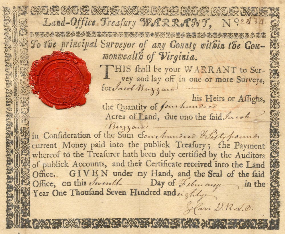
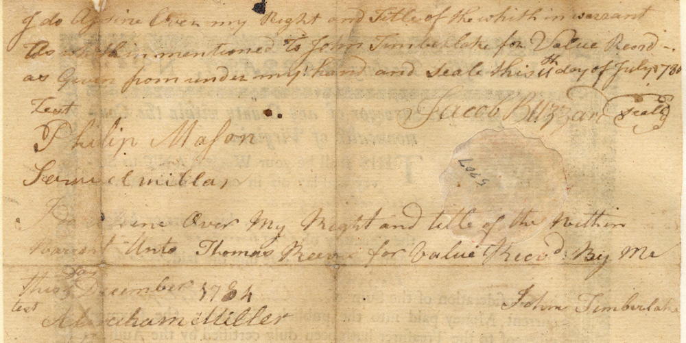
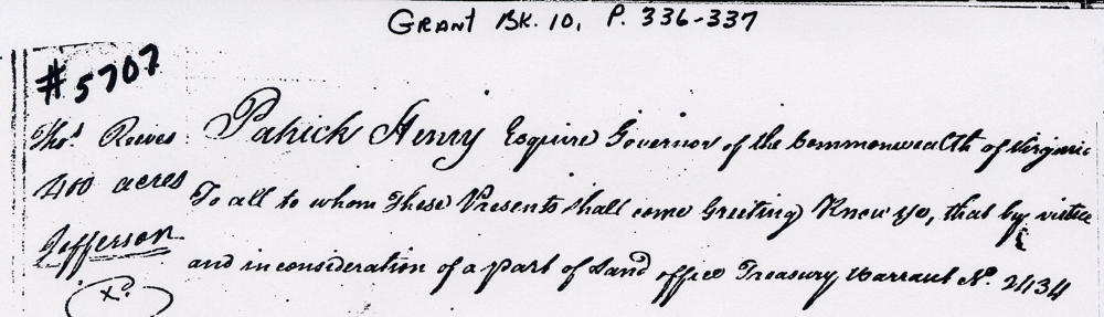
On 24 Nov 1784, Samuel Smyth surveyed 400 acres for John Timberlake on the waters of Cane Run in present-day southern Bullitt County. This was based on a treasury warrant originally issued to Jacob Buzzard who transferred it to Timberlake, as shown below. After the survey was completed, Timberlake assigned the tract to Thomas Reeves. The warrant, survey and deed are shown below along with transcriptions.
Warrant
Survey
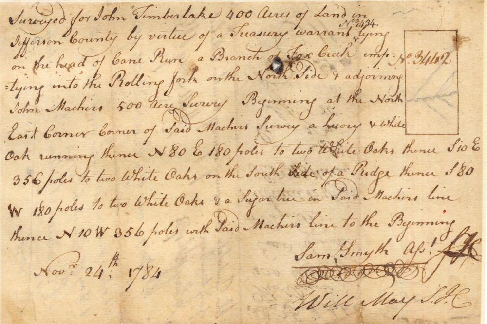
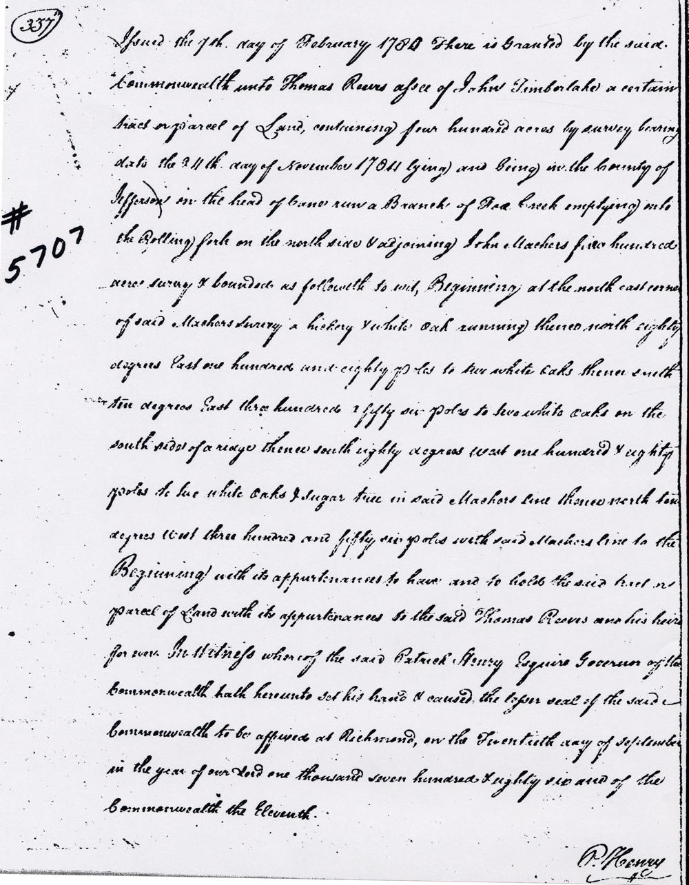
Surveyed for John Timberlake 400 acres of land in Jefferson County by virtue of a treasury warrant No. 2434, lying on the head of Can Run, a branch of Fox Creek emptying into the Rolling fork on the north side & adjoining John Machers 500 acre survey. Beginning at the northeast corner of said Machers survey a hickory & white oak, running thence N 80 E 180 poles to two white oaks, thence S 10 E 356 poles to two white oaks on the south side of a ridge, thence S 80 W 180 poles to two white oaks & a sugar tree in said Machirs line, thence N 10 W 356 poles with said Machirs line to the beginning. November 24th 1784. Sam Smyth, surveyor
Deed
If you, the reader, have an interest in any particular part of our county history, and wish to contribute to this effort, use the form on our Contact Us page to send us your comments about this, or any Bullitt County History page. We welcome your comments and suggestions. If you feel that we have misspoken at any point, please feel free to point this out to us.
The Bullitt County History Museum, a service of the Bullitt County Genealogical Society, is located in the county courthouse at 300 South Buckman Street (Highway 61) in Shepherdsville, Kentucky. The museum, along with its research room, is open 10 a.m. to 4 p.m. Monday through Friday. Saturday appointments are available by calling 502-921-0161 during our regular weekday hours. Admission is free. The museum, as part of the Bullitt County Genealogical Society, is a 501(c)3 tax exempt organization and is classified as a 509(a)2 public charity. Contributions and bequests are deductible under section 2055, 2106, or 2522 of the Internal Revenue Code. Page last modified: 12 Sep 2024 . Page URL: bullittcountyhistory.org/bchistory/thomas-reeves400.html