
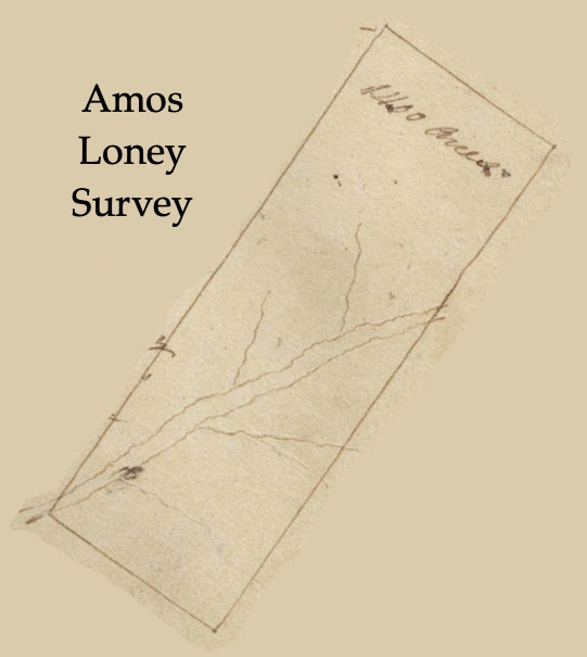
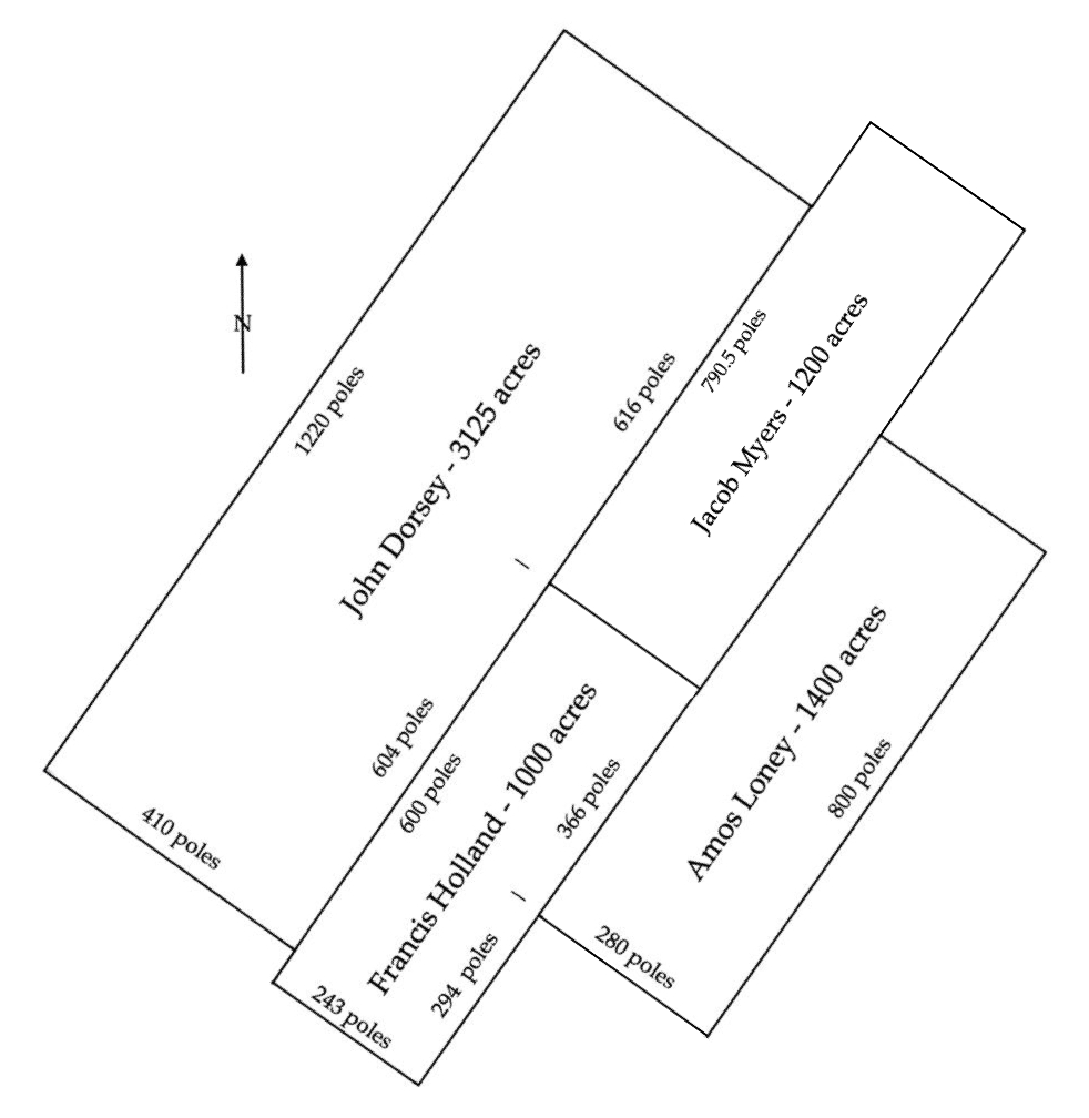
Amos Loney claimed 1400 acres that lay along the Salt River between the Rolling Fork and Mill Creek in what is today Fort Knox. According to his survey, this tract lay downstream from 1000 acres claimed by Jacob Myers which is described on another page. It adjoined another Jacob Myers tract of 1200 acres, as well as Francis Holland's 1000 acres.
Loney's tract was one of three that lay across Salt River in this area as shown on the drawing to the right below.
Survey
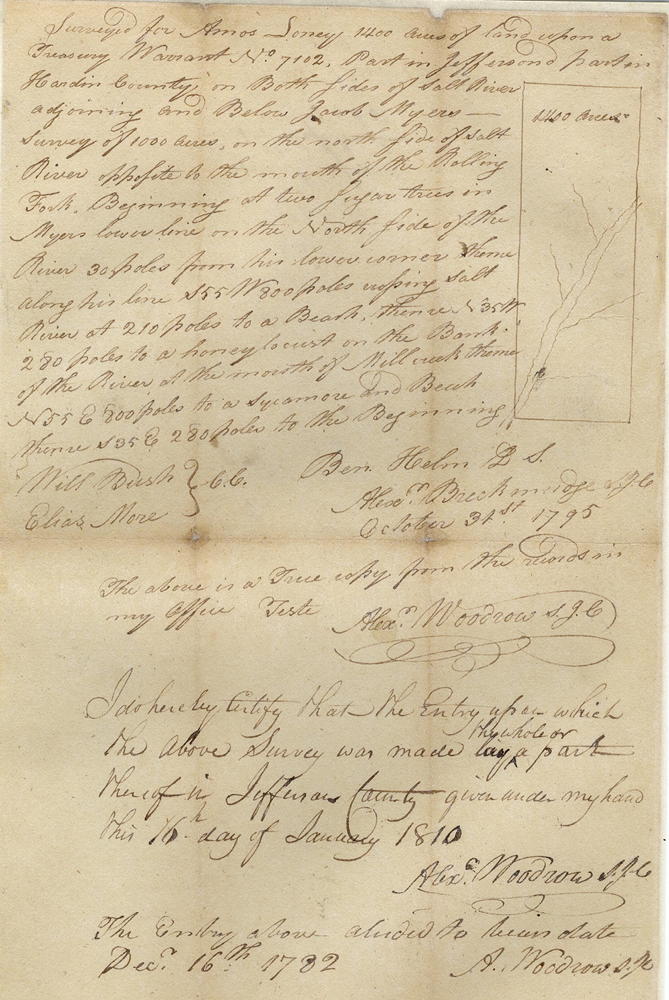
Surveyed for Amos Loney 1400 acres of land upon a Treasury Warrant No. 7102, part in Jefferson and part in Hardin County on both sides of Salt River adjoining and below Jacob Myers' survey of 1000 acres on the north side of Salt River opposite the mouth of the Rolling Fork. Beginning at two sugar trees in Myers' lower line on the north side of the river, 30 poles from his lower corner, thence along his line S 55° W 800 poles, crossing Salt River at 210 poles, to a beech, thence N 35° W 280 poles to a honey locust on the bank of the river at the mouth of Mill Creek, thence N 55° E 800 poles to a sycamore and beech, thence S 35° E 280 poles to the beginning. Ben Helm, surveyor; Will Bush and Elias More, chain carriers.
Deed
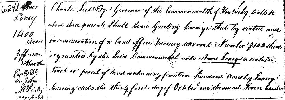
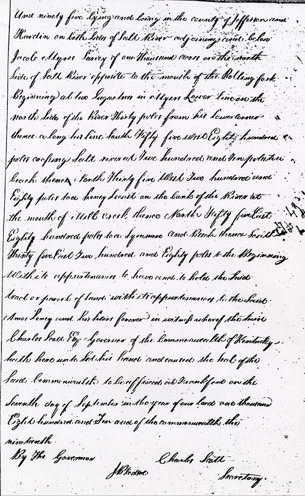
Charles Scott Esquire, Governor of the Commonwealth of Kentucky, to all to whom these presents shall come, greeting. Know ye that by virtue and in consideration of a land office treasury warrant No. ??, there is granted by the said Commonwealth unto Amos Loney a certain tract or parcel of land containing 1400 acres by survey bearing date the 31 Oct 1795, lying and being in the county of Jefferson and Hardin on both sides of Salt River adjoining and below Jacob Myers' survey of 1000 acres on the north side of Salt River opposite to the mouth of the Rolling Fork.
Beginning at two sugar trees in Myers' lower line on the north side of the river, 30 poles from his lower corner, thence along his line S 55° W 800 poles, crossing Salt River at 210 poles, to a beech, thence N 35° W 280 poles to a honey locust on the bank of the river at the mouth of Mill Creek, thence N 55° E 800 poles to a sycamore and beech, thence S 35° E 280 poles to the beginning with its appurtenances.
To have and to hold the said tract or parcel of land with its appurtenances to the said Amos Loney and his heirs forever. In witness whereof the said Charles Scott Esquire, Governor of the Commonwealth of Kentucky, hath hereunto set his hand and caused the seal of the said Commonwealth to be affixed at Frankfort on the 7th day of September in the year of our Lord 1810 and of the Commonwealth the 19th. (signed) Charle Scott
If you, the reader, have an interest in any particular part of our county history, and wish to contribute to this effort, use the form on our Contact Us page to send us your comments about this, or any Bullitt County History page. We welcome your comments and suggestions. If you feel that we have misspoken at any point, please feel free to point this out to us.
The Bullitt County History Museum, a service of the Bullitt County Genealogical Society, is located in the county courthouse at 300 South Buckman Street (Highway 61) in Shepherdsville, Kentucky. The museum, along with its research room, is open 10 a.m. to 4 p.m. Monday through Friday. Saturday appointments are available by calling 502-921-0161 during our regular weekday hours. Admission is free. The museum, as part of the Bullitt County Genealogical Society, is a 501(c)3 tax exempt organization and is classified as a 509(a)2 public charity. Contributions and bequests are deductible under section 2055, 2106, or 2522 of the Internal Revenue Code. Page last modified: 21 Apr 2026 . Page URL: bullittcountyhistory.org/bchistory/ok6241-loney.html